Difference between revisions of "2012-07-29 50 10"
imported>Reinhard (report) |
imported>FippeBot m (Location) |
||
| (One intermediate revision by one other user not shown) | |||
| Line 14: | Line 14: | ||
== Expedition == | == Expedition == | ||
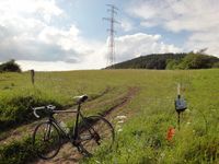
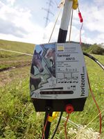
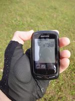
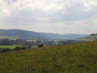
| − | I've passed this hash by less than 500 m the day before (on Saturday), when I was riding on the Werra river bicycle trail without exactly knowing that I was so close. Checked the Sunday coordinates later and was surprised to find | + | I've passed this hash by less than 500 m the day before (on Saturday), when I was riding on the Werra river bicycle trail without exactly knowing that I was so close. Checked the Sunday coordinates later and was surprised to find them there as I didn't like the idea to cycle nearly the same way again. Well, it was worth a try and I had no better idea, where to go, so I got back to the Werra and found the hash to be located in an electrically fenced area. As there was a slope, I couldn't overlook the whole area and didn't know, whether I would find animals or even farmers ready to use violence or just some peaceful sheep. I climbed a nearby highstand, but it didn't let me look much farther, so I had to jump in and prepare for panically running out again, when spotting farmers or dinosaurs. Turned out, there was neither of them, not an animal or human being at all. Probably the daisies were bared from leaving their meadow by the fence and its high voltage. So I had enough time to do a funny hash dance and catch the spot with an accuracy of 1.5 m. Meanwhile, my trusty bike had waited for me outside and afterwards took me back on a different route showing me the scenic (and hilly, I should say) roads of the so-called "Little Thuringian Forest". 58 km altogether. |
== Photos == | == Photos == | ||
| Line 28: | Line 28: | ||
[[Category:Expeditions with photos]] | [[Category:Expeditions with photos]] | ||
[[Category:Coordinates reached]] | [[Category:Coordinates reached]] | ||
| + | {{location|DE|TH|SM}} | ||
Latest revision as of 05:17, 13 August 2019
| Sun 29 Jul 2012 in 50,10: 50.5350379, 10.5237714 geohashing.info google osm bing/os kml crox |
Location
On a meadow near Vachdorf (Thuringia).
Participants
Expedition
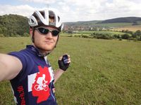
I've passed this hash by less than 500 m the day before (on Saturday), when I was riding on the Werra river bicycle trail without exactly knowing that I was so close. Checked the Sunday coordinates later and was surprised to find them there as I didn't like the idea to cycle nearly the same way again. Well, it was worth a try and I had no better idea, where to go, so I got back to the Werra and found the hash to be located in an electrically fenced area. As there was a slope, I couldn't overlook the whole area and didn't know, whether I would find animals or even farmers ready to use violence or just some peaceful sheep. I climbed a nearby highstand, but it didn't let me look much farther, so I had to jump in and prepare for panically running out again, when spotting farmers or dinosaurs. Turned out, there was neither of them, not an animal or human being at all. Probably the daisies were bared from leaving their meadow by the fence and its high voltage. So I had enough time to do a funny hash dance and catch the spot with an accuracy of 1.5 m. Meanwhile, my trusty bike had waited for me outside and afterwards took me back on a different route showing me the scenic (and hilly, I should say) roads of the so-called "Little Thuringian Forest". 58 km altogether.
Photos
|
