Difference between revisions of "2012-07-30 33 -117"
From Geohashing
imported>Scerruti (An expedition message sent via Geohash Droid for Android.) |
imported>FippeBot m (Location) |
||
| (10 intermediate revisions by 2 users not shown) | |||
| Line 1: | Line 1: | ||
| − | |||
<!-- If you did not specify these parameters in the template, please substitute appropriate values for IMAGE, LAT, LON, and DATE (YYYY-MM-DD format) | <!-- If you did not specify these parameters in the template, please substitute appropriate values for IMAGE, LAT, LON, and DATE (YYYY-MM-DD format) | ||
| Line 18: | Line 17: | ||
__NOTOC__ | __NOTOC__ | ||
== Location == | == Location == | ||
| − | + | In Bub Williamson park in Vista near Emerald and the 78. | |
== Participants == | == Participants == | ||
| − | + | * [[User:Scerruti|Stephen Cerruti]] | |
| − | + | * [[User: MitchCarroll| Mitch Carroll]] | |
== Plans == | == Plans == | ||
| − | + | Will visit in the AM or early PM. [[User:Scerruti|Stephen Cerruti]] 10:45, 30 July 2012 (EDT) | |
== Expedition == | == Expedition == | ||
<!-- how it all turned out. your narrative goes here. --> | <!-- how it all turned out. your narrative goes here. --> | ||
| + | |||
| + | *Stopped by Rubio's on the way and picked up some fish tacos to eat at the hash point with A'. -- [[User:Scerruti|Stephen Cerruti]] [http://www.openstreetmap.org/?lat=33.19782440&lon=-117.27662466&zoom=16&layers=B000FTF @33.1978,-117.2766] 15:18, 30 July 2012 (EDT) | ||
== Tracklog == | == Tracklog == | ||
<!-- if your GPS device keeps a log, you may post a link here --> | <!-- if your GPS device keeps a log, you may post a link here --> | ||
| Line 38: | Line 39: | ||
--> | --> | ||
<gallery perrow="5"> | <gallery perrow="5"> | ||
| + | |||
| + | Image:2012-07-30_33_-117_12-06-06-874.jpg | Here! [http://www.openstreetmap.org/?lat=33.19777784&lon=-117.27686590&zoom=16&layers=B000FTF @33.1978,-117.2769] | ||
| + | |||
| + | Image:2012-07-30_33_-117_12-22-37-079.jpg | [http://www.openstreetmap.org/?lat=33.19789514&lon=-117.27656121&zoom=16&layers=B000FTF @33.1979,-117.2766] | ||
| + | |||
| + | Image:2012-07-30_33_-117_12-28-06-874.jpg | There sure is a lot you can't do at this park. | ||
| + | |||
| + | Image:2012-07-30_33_-117_17-56-06-558.jpg | Geohashing with the kids! [http://www.openstreetmap.org/?lat=33.19790803&lon=-117.27668815&zoom=16&layers=B000FTF @33.1979,-117.2767] | ||
| + | |||
| + | Image:2012-07-30_33_-117_17-56-33-452.jpg | Another view of today's expedition [http://www.openstreetmap.org/?lat=33.19790823&lon=-117.27668831&zoom=16&layers=B000FTF @33.1979,-117.2767] | ||
</gallery> | </gallery> | ||
| Line 45: | Line 56: | ||
| − | |||
| − | |||
| − | |||
| − | + | [[Category:Expeditions]] | |
| − | |||
| − | [[Category: | ||
| − | |||
| − | |||
| − | |||
| − | |||
[[Category:Expeditions with photos]] | [[Category:Expeditions with photos]] | ||
| − | + | ||
| − | |||
| − | |||
| − | |||
| − | |||
[[Category:Coordinates reached]] | [[Category:Coordinates reached]] | ||
| − | + | {{location|US|CA|SD}} | |
| − | |||
| − | |||
| − | |||
| − | |||
| − | |||
| − | |||
| − | |||
| − | |||
| − | |||
| − | |||
| − | |||
| − | |||
| − | |||
| − | |||
| − | |||
| − | |||
| − | |||
Latest revision as of 05:17, 13 August 2019
| Mon 30 Jul 2012 in 33,-117: 33.1978875, -117.2767533 geohashing.info google osm bing/os kml crox |
Location
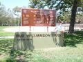
In Bub Williamson park in Vista near Emerald and the 78.
Participants
Plans
Will visit in the AM or early PM. Stephen Cerruti 10:45, 30 July 2012 (EDT)
Expedition
- Stopped by Rubio's on the way and picked up some fish tacos to eat at the hash point with A'. -- Stephen Cerruti @33.1978,-117.2766 15:18, 30 July 2012 (EDT)
Tracklog
Photos

Here! @33.1978,-117.2769
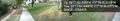
There sure is a lot you can't do at this park.
Geohashing with the kids! @33.1979,-117.2767
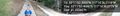
Another view of today's expedition @33.1979,-117.2767

