Difference between revisions of "2012-08-04 47 1"
imported>Dunaril ([live picture] The little wood and the field where the geohash was. [http://www.openstreetmap.org/?lat=47.64076549&lon=1.47700382&zoom=16&layers=B000FTF @47.6408,1.4770]) |
m (per Renaming Proposal) |
||
| (17 intermediate revisions by 4 users not shown) | |||
| Line 1: | Line 1: | ||
| − | |||
| − | |||
| − | |||
| − | |||
| − | |||
| − | |||
| − | |||
| − | |||
| − | |||
| − | |||
{{meetup graticule | {{meetup graticule | ||
| lat=47 | | lat=47 | ||
| Line 15: | Line 5: | ||
}} | }} | ||
| − | |||
__NOTOC__ | __NOTOC__ | ||
== Location == | == Location == | ||
| − | + | ''NE of Blois, France'' | |
| + | |||
| + | And even closer to the castle of [http://en.wikipedia.org/wiki/Ch%C3%A2teau_de_Chambord Chambord] (5km approximately) and the charming little village of Saint-Dyé-sur-Loire. | ||
== Participants == | == Participants == | ||
| − | + | [[User:Dunaril|Dunaril]] and [[User:Katu|Katu]] | |
| − | |||
== Plans == | == Plans == | ||
| − | + | ||
| + | *Hello Geohashers! We'll fill this when we are back from vacation. Short story long: On our way from Chambord to Blois (2 amazing castles on the Loire Valley), we couldn't resist saying hi to the luckily very close local Geohash.. and maybe opening the score for this cool graticule. More info to come! Dunaril and Katu. -- [[User:Dunaril|Dunaril]] [http://www.openstreetmap.org/?lat=47.63970552&lon=1.47996959&zoom=16&layers=B000FTF @47.6397,1.4800] 15:44, 4 August 2012 (CEST) | ||
| + | |||
| + | *So, our vacations took longer than expected... I'm finally updating this page with a bit more story. This was the first day of our week-long road trip from Paris to the Loire castles (Chambord, Amboise, Chinon, Fontevraud...) and the Brittany coasts. Out of habit I had checked the geohash along our road for this day, and found it to be very close to our first destination, Chambord. We really didn't need to make a detour to be a few kilometers away from the geohash :) -- [[User:Dunaril|Dunaril]] 00:19, 20 August 2013 (CEST) | ||
== Expedition == | == Expedition == | ||
| − | + | ''Looks like they made it'' | |
| + | We did, thanks for updating this page! | ||
| − | + | After a very nice visit of Chambord, we went to Saint-Dyé-sur-Loire for a picnic on the Loire shore and passed close to the geohash. Once filled we went back on our tracks and used Maps to get a visual of the target field and decide how to get there. The hash was in an open field close to a little forest and a few modern houses, and so after parking along the closest road we followed a little trail between the forest and the gardens (nobody seemed to notice or pay attention to us). | |
| − | + | ||
| − | + | Once at the edge of the field we used my phone's GPS to walk to the exact spot and minimize the distance over the field itself. We took a picture and went back to the car and road trip. | |
| + | |||
| + | This wasn't a very exciting hash, but we deflowered the Orleans graticule :) | ||
== Photos == | == Photos == | ||
| − | |||
| − | |||
| − | |||
<gallery perrow="5"> | <gallery perrow="5"> | ||
| Line 46: | Line 39: | ||
Image:2012-08-04_47_1_15-50-17-220.jpg | The little wood and the field where the geohash was. [http://www.openstreetmap.org/?lat=47.64076549&lon=1.47700382&zoom=16&layers=B000FTF @47.6408,1.4770] | Image:2012-08-04_47_1_15-50-17-220.jpg | The little wood and the field where the geohash was. [http://www.openstreetmap.org/?lat=47.64076549&lon=1.47700382&zoom=16&layers=B000FTF @47.6408,1.4770] | ||
| + | |||
| + | Image:2012-08-04_47_1_15-50-50-301.jpg | Ready for the adventure! [http://www.openstreetmap.org/?lat=47.64065686&lon=1.47664533&zoom=16&layers=B000FTF @47.6407,1.4766] | ||
</gallery> | </gallery> | ||
== Achievements == | == Achievements == | ||
{{#vardefine:ribbonwidth|800px}} | {{#vardefine:ribbonwidth|800px}} | ||
| − | + | {{land geohash | latitude = 47 | longitude = 1 | date = 2012-08-04 | name = [[User:Dunaril|Dunaril]] and [[User:Katu|Katu]]}} | |
| + | {{Graticule unlocked | latitude = 47 | longitude = 1 | date = 2012-08-04 | name = [[User:Dunaril|Dunaril]] and [[User:Katu|Katu]]}} | ||
| + | {{Minesweeper geohash | graticule = Paris, France | ranknumber = 1 | sw = true | name = [[User:Dunaril|Dunaril]] and [[User:Katu|Katu]] }} | ||
| − | |||
| − | |||
| − | |||
| − | |||
| − | |||
| − | |||
| − | |||
| − | |||
| − | |||
| − | |||
| − | |||
[[Category:Expeditions]] | [[Category:Expeditions]] | ||
| − | |||
[[Category:Expeditions with photos]] | [[Category:Expeditions with photos]] | ||
| − | |||
| − | |||
| − | |||
| − | |||
| − | |||
[[Category:Coordinates reached]] | [[Category:Coordinates reached]] | ||
| − | + | {{location|FR|41}} | |
| − | |||
| − | |||
| − | |||
| − | |||
| − | |||
| − | |||
| − | |||
| − | |||
| − | |||
| − | |||
| − | |||
| − | |||
| − | |||
| − | |||
| − | |||
| − | |||
| − | |||
Latest revision as of 05:33, 20 March 2024
| Sat 4 Aug 2012 in 47,1: 47.6396922, 1.4799171 geohashing.info google osm bing/os kml crox |
Location
NE of Blois, France
And even closer to the castle of Chambord (5km approximately) and the charming little village of Saint-Dyé-sur-Loire.
Participants
Plans
- Hello Geohashers! We'll fill this when we are back from vacation. Short story long: On our way from Chambord to Blois (2 amazing castles on the Loire Valley), we couldn't resist saying hi to the luckily very close local Geohash.. and maybe opening the score for this cool graticule. More info to come! Dunaril and Katu. -- Dunaril @47.6397,1.4800 15:44, 4 August 2012 (CEST)
- So, our vacations took longer than expected... I'm finally updating this page with a bit more story. This was the first day of our week-long road trip from Paris to the Loire castles (Chambord, Amboise, Chinon, Fontevraud...) and the Brittany coasts. Out of habit I had checked the geohash along our road for this day, and found it to be very close to our first destination, Chambord. We really didn't need to make a detour to be a few kilometers away from the geohash :) -- Dunaril 00:19, 20 August 2013 (CEST)
Expedition
Looks like they made it
We did, thanks for updating this page!
After a very nice visit of Chambord, we went to Saint-Dyé-sur-Loire for a picnic on the Loire shore and passed close to the geohash. Once filled we went back on our tracks and used Maps to get a visual of the target field and decide how to get there. The hash was in an open field close to a little forest and a few modern houses, and so after parking along the closest road we followed a little trail between the forest and the gardens (nobody seemed to notice or pay attention to us).
Once at the edge of the field we used my phone's GPS to walk to the exact spot and minimize the distance over the field itself. We took a picture and went back to the car and road trip.
This wasn't a very exciting hash, but we deflowered the Orleans graticule :)
Photos
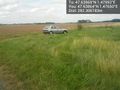
Car parked 250m from the hash @47.6386,1.4765

Yay! @47.6397,1.4799
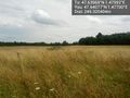
The little wood and the field where the geohash was. @47.6408,1.4770

Ready for the adventure! @47.6407,1.4766


Achievements
Dunaril and Katu earned the Land geohash achievement
|
Dunaril and Katu earned the Graticule Unlocked Achievement
|
Dunaril and Katu achieved level 1 of the Minesweeper Geohash achievement
|