Difference between revisions of "2012-08-11 48 9"
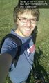
imported>DarkMark ([live picture] I did it! [http://www.openstreetmap.org/?lat=48.71183395&lon=9.50167179&zoom=16&layers=B000FTF @48.7118,9.5017]) |
imported>DarkMark |
||
| Line 1: | Line 1: | ||
| − | |||
<!-- If you did not specify these parameters in the template, please substitute appropriate values for IMAGE, LAT, LON, and DATE (YYYY-MM-DD format) | <!-- If you did not specify these parameters in the template, please substitute appropriate values for IMAGE, LAT, LON, and DATE (YYYY-MM-DD format) | ||
| Line 18: | Line 17: | ||
__NOTOC__ | __NOTOC__ | ||
== Location == | == Location == | ||
| − | + | The location was close enough to be reached by bike, and I knew part of the way how to get there. So I just started. From the map it looked like it was on some field. | |
| + | |||
| + | |||
== Participants == | == Participants == | ||
| − | + | [[DarkMark]] | |
| − | |||
== Plans == | == Plans == | ||
| − | + | Just getting there and doing a little sport on the way. | |
== Expedition == | == Expedition == | ||
| − | + | I used today's geohash for a bike trip. Most of the way went rather smooth. It was 20km as the bird flies and without training I thought it would be easy. But it did get tiresome before the end for me; I noticed I cannot drive the same way as the bird flies. And there were mountains! Well not really, a very small hill, but still. I had to drive quite some more distance to reach the place, as I had to cross a big highway and needed a bride. When I finally reached the place, I found that it was just 2 meters from a bike track. It would have been much easier to reach that place if I had known that before... But well, let's see things positive, it was easier to get back. And the good feeling of having reached my first geohash felt really good :) | |
| − | |||
| − | |||
== Photos == | == Photos == | ||
| Line 49: | Line 47: | ||
<!-- =============== USEFUL CATEGORIES FOLLOW ================ | <!-- =============== USEFUL CATEGORIES FOLLOW ================ | ||
Delete the next line ONLY if you have chosen the appropriate categories below. If you are unsure, don't worry. People will read your report and help you with the classification. --> | Delete the next line ONLY if you have chosen the appropriate categories below. If you are unsure, don't worry. People will read your report and help you with the classification. --> | ||
| − | |||
| − | |||
| − | |||
| − | |||
| − | |||
| − | |||
| − | |||
| − | |||
| − | |||
[[Category:Expeditions with photos]] | [[Category:Expeditions with photos]] | ||
| − | |||
[[Category:Expedition without GPS]] | [[Category:Expedition without GPS]] | ||
| − | |||
| − | |||
| − | |||
[[Category:Coordinates reached]] | [[Category:Coordinates reached]] | ||
| − | |||
| − | |||
| − | |||
| − | |||
| − | |||
| − | |||
| − | |||
| − | |||
| − | |||
| − | |||
| − | |||
| − | |||
| − | |||
| − | |||
| − | |||
| − | |||
| − | |||
| − | |||
Revision as of 20:27, 11 August 2012
| Sat 11 Aug 2012 in 48,9: 48.7118274, 9.5016661 geohashing.info google osm bing/os kml crox |
Location
The location was close enough to be reached by bike, and I knew part of the way how to get there. So I just started. From the map it looked like it was on some field.
Participants
Plans
Just getting there and doing a little sport on the way.
Expedition
I used today's geohash for a bike trip. Most of the way went rather smooth. It was 20km as the bird flies and without training I thought it would be easy. But it did get tiresome before the end for me; I noticed I cannot drive the same way as the bird flies. And there were mountains! Well not really, a very small hill, but still. I had to drive quite some more distance to reach the place, as I had to cross a big highway and needed a bride. When I finally reached the place, I found that it was just 2 meters from a bike track. It would have been much easier to reach that place if I had known that before... But well, let's see things positive, it was easier to get back. And the good feeling of having reached my first geohash felt really good :)
Photos
I did it! @48.7118,9.5017
