Difference between revisions of "2012-08-11 55 12"
imported>Nesk (→Achievements) |
imported>Eldin m (clean up template and check categories.) |
||
| Line 1: | Line 1: | ||
| − | |||
| − | |||
| − | |||
| − | |||
| − | |||
| − | |||
| − | |||
| − | |||
| − | |||
{{meetup graticule | {{meetup graticule | ||
| lat=55 | | lat=55 | ||
| Line 14: | Line 5: | ||
}} | }} | ||
| − | |||
__NOTOC__ | __NOTOC__ | ||
== Location == | == Location == | ||
| − | |||
On a field on the banks of the wetlands of Utterslev Mose in the outer boroughs of Copenhagen | On a field on the banks of the wetlands of Utterslev Mose in the outer boroughs of Copenhagen | ||
== Participants == | == Participants == | ||
| − | |||
| − | |||
[[User:Nesk|Nesk]] | [[User:Nesk|Nesk]] | ||
== Plans == | == Plans == | ||
| − | |||
It wasn't too far from my home (3.5 km) - in fact, rather close the route I ocassionally use for running. I figured it could be reached by a short bike ride. | It wasn't too far from my home (3.5 km) - in fact, rather close the route I ocassionally use for running. I figured it could be reached by a short bike ride. | ||
== Expedition == | == Expedition == | ||
| − | + | Venturing out during the early afternoon hours after having studied the map as thoroughly as I saw fit, I was under the impression of entertaining a fairly precise idea as to where the hash could be found. Indeed, I ventured in the general direction of the point with little to no effort. | |
| − | Venturing out during the early afternoon hours after having studied the map as thoroughly as I saw fit, I was under the impression of entertaining a fairly precise idea as to where the hash could be found. Indeed, I ventured in the general direction of the point with little to no effort. The paths across and around the wetlands are winding and treacherous, however, and I was for some reason unable to view maps on my phone. Such are the forces that make short bike rides rather long. Later when reviewing the route taken, I ponder if I actually managed to trace out a Weierstrass function unknowingly. Relying on coordinates, and the eventual return of the map functionality to my phone, the goal was reached. It was indeed a rather featureless soccer field, which lend itself to a brief photo session, the conclusion of which was followed by my immediate departure from the scene. | + | |
| + | The paths across and around the wetlands are winding and treacherous, however, and I was for some reason unable to view maps on my phone. Such are the forces that make short bike rides rather long. Later when reviewing the route taken, I ponder if I actually managed to trace out a Weierstrass function unknowingly. Relying on coordinates, and the eventual return of the map functionality to my phone, the goal was reached. It was indeed a rather featureless soccer field, which lend itself to a brief photo session, the conclusion of which was followed by my immediate departure from the scene. | ||
| − | |||
| − | |||
== Photos == | == Photos == | ||
| − | |||
| − | |||
| − | |||
<gallery perrow="5"> | <gallery perrow="5"> | ||
Image:2012_08_11_55_12_TheSpot.jpg | A patch of grass whcih might never have been noticed where it not for geohashing. Thanks, geohashing. Thashing. | Image:2012_08_11_55_12_TheSpot.jpg | A patch of grass whcih might never have been noticed where it not for geohashing. Thanks, geohashing. Thashing. | ||
| Line 56: | Line 38: | ||
}} | }} | ||
| − | |||
| − | |||
| − | |||
| − | |||
| − | |||
| − | |||
| − | |||
| − | |||
| − | |||
| − | |||
[[Category:Expeditions]] | [[Category:Expeditions]] | ||
| − | |||
[[Category:Expeditions with photos]] | [[Category:Expeditions with photos]] | ||
| − | |||
| − | |||
| − | |||
| − | |||
| − | |||
[[Category:Coordinates reached]] | [[Category:Coordinates reached]] | ||
| − | |||
| − | |||
| − | |||
| − | |||
| − | |||
| − | |||
| − | |||
| − | |||
| − | |||
| − | |||
| − | |||
| − | |||
| − | |||
| − | |||
| − | |||
| − | |||
| − | |||
| − | |||
Revision as of 23:51, 28 May 2013
| Sat 11 Aug 2012 in 55,12: 55.7118274, 12.5016661 geohashing.info google osm bing/os kml crox |
Location
On a field on the banks of the wetlands of Utterslev Mose in the outer boroughs of Copenhagen
Participants
Plans
It wasn't too far from my home (3.5 km) - in fact, rather close the route I ocassionally use for running. I figured it could be reached by a short bike ride.
Expedition
Venturing out during the early afternoon hours after having studied the map as thoroughly as I saw fit, I was under the impression of entertaining a fairly precise idea as to where the hash could be found. Indeed, I ventured in the general direction of the point with little to no effort.
The paths across and around the wetlands are winding and treacherous, however, and I was for some reason unable to view maps on my phone. Such are the forces that make short bike rides rather long. Later when reviewing the route taken, I ponder if I actually managed to trace out a Weierstrass function unknowingly. Relying on coordinates, and the eventual return of the map functionality to my phone, the goal was reached. It was indeed a rather featureless soccer field, which lend itself to a brief photo session, the conclusion of which was followed by my immediate departure from the scene.
Photos
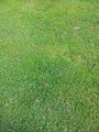
A patch of grass whcih might never have been noticed where it not for geohashing. Thanks, geohashing. Thashing.
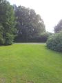
The road next to the spot, as viewed from the spot itself.
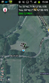
Proof that a phone was close to the spot.


Achievements
Nesk earned the Land geohash achievement
|