Difference between revisions of "2012-08-19 54 -3"
imported>Alexandersmith |
imported>Alexandersmith |
||
| Line 1: | Line 1: | ||
2012-08-19 54 -3 | 2012-08-19 54 -3 | ||
| − | |||
| − | |||
| − | |||
| − | |||
| − | |||
| − | |||
| − | |||
| − | |||
| − | |||
{{meetup graticule | {{meetup graticule | ||
| lat=54 | | lat=54 | ||
| Line 19: | Line 10: | ||
__NOTOC__ | __NOTOC__ | ||
== Location == | == Location == | ||
| − | + | Near Bouth, England. | |
== Participants == | == Participants == | ||
| − | + | * [[User:Alexandersmith|Alexandersmith]] | |
| − | |||
| − | |||
| − | |||
| − | |||
| − | |||
| − | |||
| − | |||
| − | |||
| − | |||
| − | |||
| − | |||
| − | |||
| − | |||
| − | |||
| − | |||
| − | |||
| − | |||
| − | |||
| − | |||
| − | |||
| − | |||
| − | |||
| − | |||
| − | |||
| − | |||
| − | [[ | ||
| − | |||
| − | |||
| − | |||
| − | |||
| − | |||
| − | |||
| − | |||
| − | |||
| − | |||
| − | |||
| − | |||
| − | |||
| − | |||
| − | |||
| − | |||
| − | |||
| − | |||
| − | |||
| − | |||
| − | |||
| − | |||
| − | |||
| − | |||
| − | |||
| − | |||
| − | |||
| − | |||
| − | |||
| − | |||
| − | |||
| − | |||
| − | |||
| − | |||
| − | |||
| − | |||
| − | |||
| − | |||
| − | |||
== Plans == | == Plans == | ||
Bag a mountain bike ride in the early part of the day, visit the meet-up point on the way back home to Barrow-in-Furness. | Bag a mountain bike ride in the early part of the day, visit the meet-up point on the way back home to Barrow-in-Furness. | ||
The meet-up point was very close to a narrow road, with a reasonable parking place opposite Bouth village hall. | The meet-up point was very close to a narrow road, with a reasonable parking place opposite Bouth village hall. | ||
| + | |||
== Expedition == | == Expedition == | ||
While I was a little bit excited on my first geo-hash, the mechanics were a bit dull. | While I was a little bit excited on my first geo-hash, the mechanics were a bit dull. | ||
| Line 105: | Line 33: | ||
The geo-hash seemed to be on the border of a small forest, and someone's back garden. There was never any danger of it turning in to a No Tresspassing Geohash, as there seemed to be nobody about. | The geo-hash seemed to be on the border of a small forest, and someone's back garden. There was never any danger of it turning in to a No Tresspassing Geohash, as there seemed to be nobody about. | ||
| + | |||
== Tracklog == | == Tracklog == | ||
There's no tracklog. I have a photo of my phone, with the Geohash app showing my location and the proximity to the geohash location. | There's no tracklog. I have a photo of my phone, with the Geohash app showing my location and the proximity to the geohash location. | ||
| − | == Photos == | + | |
| + | == Photos == | ||
<gallery perrow="2"> | <gallery perrow="2"> | ||
| Line 115: | Line 45: | ||
</gallery> | </gallery> | ||
| + | |||
== Achievements == | == Achievements == | ||
| − | + | {{#vardefine:ribbonwidth|800px}} | |
| − | |||
{{Land geohash | latitude = 54 | longitude = -3 | date = 2012-08-19 | name = Alexandersmith}} | {{Land geohash | latitude = 54 | longitude = -3 | date = 2012-08-19 | name = Alexandersmith}} | ||
[[Category:Land geohash achievement]] | [[Category:Land geohash achievement]] | ||
| Line 124: | Line 54: | ||
[[Category:Expeditions with photos]] | [[Category:Expeditions with photos]] | ||
[[Category:Coordinates reached]] | [[Category:Coordinates reached]] | ||
| + | [[Category:New report]] | ||
Revision as of 17:54, 19 August 2012
2012-08-19 54 -3
| Sun 19 Aug 2012 in 54,-3: 54.2624920, -3.0300963 geohashing.info google osm bing/os kml crox |
Location
Near Bouth, England.
Participants
Plans
Bag a mountain bike ride in the early part of the day, visit the meet-up point on the way back home to Barrow-in-Furness. The meet-up point was very close to a narrow road, with a reasonable parking place opposite Bouth village hall.
Expedition
While I was a little bit excited on my first geo-hash, the mechanics were a bit dull.
At home, at the beginning of the day, I had checked the location of the geohash point, and sussed out that I could park within about 50 metres of it.
I put my Android phone in the 99pence dashboard holder, started the Geohash Droid app, and drove to the parking place I had chosen earlier.
The weather was drizzling with intermittent breaks of sun. Not enough to qualify for the drowned rat award. Before leaving the car, I took the precaution of putting my phone in a waterproof bag.
I went through the outer gate of the village hall, and scaled the fence behind it. Finding myself in a forest, I picked my way up a small hill while trying to keep my phone held upwards so the GPS receiver had a decent view of the sky. After a small amount of wandering around in decreasing circles, and watching the apparent GPS location wander about, I was able to get a stable reading of 1.53metres away from the official geohash.
Close enough, I shot two photos and left.
The geo-hash seemed to be on the border of a small forest, and someone's back garden. There was never any danger of it turning in to a No Tresspassing Geohash, as there seemed to be nobody about.
Tracklog
There's no tracklog. I have a photo of my phone, with the Geohash app showing my location and the proximity to the geohash location.
Photos

Auto photo at the location
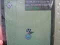
Android Geohash app showing my location


Achievements
Alexandersmith earned the Land geohash achievement
|