Difference between revisions of "2012-09-10 58 8"
imported>MartinK m (→Photos) |
m (2020-01-01 update) |
||
| (4 intermediate revisions by 3 users not shown) | |||
| Line 1: | Line 1: | ||
| − | + | [[Image:{{{image|2012-09-10 17.27.27.jpg}}}|thumb|left]] | |
| − | |||
| − | |||
| − | |||
| − | |||
| − | |||
| − | |||
| − | |||
{{meetup graticule | {{meetup graticule | ||
| lat=58 | | lat=58 | ||
| Line 14: | Line 7: | ||
}} | }} | ||
| − | + | ||
__NOTOC__ | __NOTOC__ | ||
== Location == | == Location == | ||
| Line 20: | Line 13: | ||
== Participants == | == Participants == | ||
| − | |||
| − | A family member of [[User:MartinK|MartinK]] | + | * [[User:MartinK|MartinK]] |
| + | * A family member of [[User:MartinK|MartinK]] | ||
== Plans == | == Plans == | ||
| Line 46: | Line 39: | ||
== Achievements == | == Achievements == | ||
{{#vardefine:ribbonwidth|800px}} | {{#vardefine:ribbonwidth|800px}} | ||
| + | |||
{{drag-along | {{drag-along | ||
| latitude = 58 | | latitude = 58 | ||
| longitude = 8 | | longitude = 8 | ||
| date = 2012-09-10 | | date = 2012-09-10 | ||
| − | |||
| name = [[User:MartinK|MartinK]] | | name = [[User:MartinK|MartinK]] | ||
| − | |||
}} | }} | ||
| − | |||
| − | |||
| − | |||
[[Category:Expeditions]] | [[Category:Expeditions]] | ||
[[Category:Expeditions with photos]] | [[Category:Expeditions with photos]] | ||
[[Category:Coordinates reached]] | [[Category:Coordinates reached]] | ||
| + | {{location|NO|42}} | ||
Latest revision as of 00:16, 16 February 2020

| Mon 10 Sep 2012 in 58,8: 58.4656186, 8.3089016 geohashing.info google osm bing/os kml crox |
Location
The geohash is on a hill near Stoveland farm, west of Herefossfjorden. A hike of about a kilometer is required to reach it. From Lillesand we have to drive through Birkeland, over the Sennumstad bridge, follow the roadsign towards Stoveland, and find a suitable place to park. The terrain is hilly and mostly forested. There is two hilltops close by that will probably provide a pretty view of Herefossfjorden, Troåsen (336 m.a.s.l) and Småheiene (333 m.a.s.l.). The geohash itself is at 310 m.a.s.l, which is about 140 meters above the planned parking spot.
Participants
Plans
MartinK plans to take a friend or more to get the Drag-along achievement. The plan is to drive from Lillesand after school and work, drive to Stoveland and walk from there. And if we feel like it go to the top of Troåsen (336 m.a.s.l) and Småheiene (333 m.a.s.l). And probably pick and eat some blueberries on the way :-)
Expedition
The expedition went as planned up to the geohash. Because of time constraints we didn't go to the hilltops. On the walk up MartinK walked over a snake without noticing. The dragged along family member noticed it though, so we photographed it. There was still a few blueberries, as well as lingonberries and bog bilberries.
Tracklog
Photos
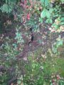
Snake.
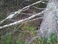
The snake didn't cooperate with the photographer.
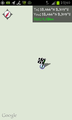
Screenshot of Geohash Droid.
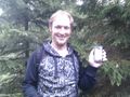
MartinK grinning stupidly ;-)
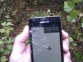
GPS device.


Achievements
MartinK earned the Drag-along achievement
|