Difference between revisions of "2012-09-11 50 10"
imported>Mampfred (An expedition message sent via Geohash Droid for Android.) |
imported>FippeBot m (Location) |
||
| (3 intermediate revisions by one other user not shown) | |||
| Line 1: | Line 1: | ||
| − | |||
| − | |||
| − | |||
| − | |||
| − | |||
| − | |||
| − | |||
| − | |||
| − | |||
| − | |||
{{meetup graticule | {{meetup graticule | ||
| lat=50 | | lat=50 | ||
| Line 15: | Line 5: | ||
}} | }} | ||
| − | |||
__NOTOC__ | __NOTOC__ | ||
== Location == | == Location == | ||
| − | + | A field near Erfurt. A VERY VERY MUDDY field at that. And there's going to be mud. And rain. Did I mention that? | |
== Participants == | == Participants == | ||
| − | + | * [[User:Rincewind|Rincewind]] | |
| − | + | * [[User:Mampfred|Mampfred]] | |
== Plans == | == Plans == | ||
| − | + | Go there after Rincewind has finished his gazillion other thigs he's got to do after work. Oui? | |
== Expedition == | == Expedition == | ||
| − | + | We met up at 9:45pm and headed for a 30 minute drive to the hash. To make the expected mud more fun, it was raining at the time and didn't stop until after we got back home. | |
| + | |||
| + | When we reached the point at the edge of the field, we both noticed that in our meticulous planning we both forgot to bring a torch. Hmm. Fortunately modern technology (= our mobiles) comes with integrated torches (= led flashes) and Rincewind had not one but two umbrellas in the car. | ||
| + | |||
| + | If I haven't stressed that enough yet - it was spectacularly muddy in that field, it took a mere three steps to have a ton of mud on our feet and we were exhausted after the first 100 meters with another 400 remaining ;) | ||
| + | |||
| + | But we made it there and back to the car where my GPS cut out due to batteries, hence only half a tracklog this time. | ||
| + | |||
| + | Tags: Fun. Wet. Dark. MUDDY. | ||
| + | |||
| + | Also YAY for 100 successful hashes for Mampfred :D | ||
== Tracklog == | == Tracklog == | ||
| − | + | See [http://www.everytrail.com/view_trip.php?trip_id=1765735 here]. | |
== Photos == | == Photos == | ||
| − | |||
| − | |||
| − | |||
<gallery perrow="5"> | <gallery perrow="5"> | ||
| + | Image:2012-09-11_50_10_coordinates_reached.jpg | Coordinates reached. | ||
| + | Image:2012-09-11_50_10_23-19-34-493.jpg | Stupid grin. | ||
</gallery> | </gallery> | ||
== Achievements == | == Achievements == | ||
{{#vardefine:ribbonwidth|800px}} | {{#vardefine:ribbonwidth|800px}} | ||
| − | + | * Land | |
| − | |||
| − | |||
| − | |||
| − | |||
| − | |||
| − | |||
| − | |||
| − | |||
| − | |||
| − | |||
| − | |||
[[Category:Expeditions]] | [[Category:Expeditions]] | ||
| − | |||
[[Category:Expeditions with photos]] | [[Category:Expeditions with photos]] | ||
| − | |||
| − | |||
| − | |||
| − | |||
| − | |||
[[Category:Coordinates reached]] | [[Category:Coordinates reached]] | ||
| − | + | {{location|DE|TH|IK}} | |
| − | |||
| − | |||
| − | |||
| − | |||
| − | |||
| − | |||
| − | |||
| − | |||
| − | |||
| − | |||
| − | |||
| − | |||
| − | |||
| − | |||
| − | |||
| − | |||
| − | |||
Latest revision as of 06:03, 13 August 2019
| Tue 11 Sep 2012 in 50,10: 50.8742128, 10.9079305 geohashing.info google osm bing/os kml crox |
Location
A field near Erfurt. A VERY VERY MUDDY field at that. And there's going to be mud. And rain. Did I mention that?
Participants
Plans
Go there after Rincewind has finished his gazillion other thigs he's got to do after work. Oui?
Expedition
We met up at 9:45pm and headed for a 30 minute drive to the hash. To make the expected mud more fun, it was raining at the time and didn't stop until after we got back home.
When we reached the point at the edge of the field, we both noticed that in our meticulous planning we both forgot to bring a torch. Hmm. Fortunately modern technology (= our mobiles) comes with integrated torches (= led flashes) and Rincewind had not one but two umbrellas in the car.
If I haven't stressed that enough yet - it was spectacularly muddy in that field, it took a mere three steps to have a ton of mud on our feet and we were exhausted after the first 100 meters with another 400 remaining ;)
But we made it there and back to the car where my GPS cut out due to batteries, hence only half a tracklog this time.
Tags: Fun. Wet. Dark. MUDDY.
Also YAY for 100 successful hashes for Mampfred :D
Tracklog
See here.
Photos
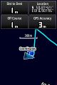
Coordinates reached.
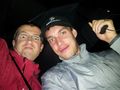
Stupid grin.


Achievements
- Land