Difference between revisions of "2012-10-05 55 37"
imported>Vb (→Expedition) |
imported>Vb (→Photos) |
||
| Line 43: | Line 43: | ||
--> | --> | ||
<gallery perrow="5"> | <gallery perrow="5"> | ||
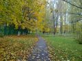
| + | Image:2012-10-05_13.39.11.jpg | the hash | ||
| + | |||
| + | Image:2012-10-05_13.39.17.jpg | the sky | ||
| + | |||
| + | Image:2012-10-05 13.37.jpg | the proof | ||
| + | |||
| + | Image:2012-10-05 13.40.16.gif | the gif | ||
| + | |||
| + | Image:2012-10-05 14.40 597.jpg | passing trough Mosrentgen on the way bach | ||
| + | |||
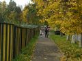
| + | Image:2012-10-05 14.55 598.jpg | passing trough Tyoply stan on the way bach | ||
</gallery> | </gallery> | ||
Revision as of 15:41, 5 October 2012
| Fri 5 Oct 2012 in 55,37: 55.6099986, 37.4351693 geohashing.info google osm bing/os kml crox |
Location
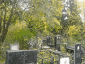
Khovanskoye Cemetery just off the (old) Moscow city limits. Again.
Participants
Plans
Expedition
Walked all the way from home (9.4km according to GPS odometer) and back (9km).
Bypassed the extremely unfriendly road this time (as opposed to that time) by walking trough Tyoply Stan and Mosrentgen districts, which a bit lengthened my way.
Got a bit lost on the way to the cemetery. Got a bit lost when was trying to find aunt's grave (finally realized that I can't remember where it is simply because I never knew it).
Had a lunch on the way back in a small cafe on the outskirts of Mosrentgen. Despite their advertisement it seems they was really surprised to see somebody but their regulars from the near military object.
Tracklog
Photos
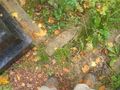
the hash

the sky
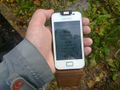
the proof
the gif
passing trough Mosrentgen on the way bach
passing trough Tyoply stan on the way bach


