Difference between revisions of "2012-10-06 55 37"
imported>Vb ([live picture] Leaving the trail [http://www.openstreetmap.org/?lat=55.85640000&lon=37.76000000&zoom=16&layers=B000FTF @55.8564,37.7600]) |
imported>Vb |
||
| Line 1: | Line 1: | ||
| − | |||
<!-- If you did not specify these parameters in the template, please substitute appropriate values for IMAGE, LAT, LON, and DATE (YYYY-MM-DD format) | <!-- If you did not specify these parameters in the template, please substitute appropriate values for IMAGE, LAT, LON, and DATE (YYYY-MM-DD format) | ||
| Line 19: | Line 18: | ||
== Location == | == Location == | ||
<!-- where you've surveyed the hash to be --> | <!-- where you've surveyed the hash to be --> | ||
| + | In Losiny Ostrov National Park. | ||
== Participants == | == Participants == | ||
<!-- who attended: If you link to your wiki user name in this section, your expedition will be picked up by the various statistics generated for geohashing. You may use three tildes ~ as a shortcut to automatically insert the user signature of the account you are editing with. | <!-- who attended: If you link to your wiki user name in this section, your expedition will be picked up by the various statistics generated for geohashing. You may use three tildes ~ as a shortcut to automatically insert the user signature of the account you are editing with. | ||
--> | --> | ||
| + | [[User:Vb|vb]] | ||
== Plans == | == Plans == | ||
<!-- what were the original plans --> | <!-- what were the original plans --> | ||
| + | The hash is about 100m from the nearest trail, about 3km into the woods from the entrance to the park, which is about 2.5km from the nearest Metro station. About a half of the trail to the hash is concrete road. | ||
== Expedition == | == Expedition == | ||
<!-- how it all turned out. your narrative goes here. --> | <!-- how it all turned out. your narrative goes here. --> | ||
| + | Leaving home noticed that my android phone is almost discharged. Charging took time, so I left later than expected. Last 100m off the trail took long time also, so when I got to the hash it was almost dark. | ||
| + | |||
| + | GPS couldn't decide where exactly am I, showing me some random constantly changing numbers, so it is really within a precision. | ||
| + | |||
| + | Android still phone died almost exactly after I reached the hash, so I continued with the symbian one. | ||
| + | |||
| + | Left at the hash semi-deflated balloon that I found near the trail earlier. | ||
== Tracklog == | == Tracklog == | ||
| Line 44: | Line 53: | ||
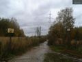
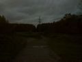
Image:2012-10-06_55_37_18-14-55-867.jpg | Leaving the trail [http://www.openstreetmap.org/?lat=55.85640000&lon=37.76000000&zoom=16&layers=B000FTF @55.8564,37.7600] | Image:2012-10-06_55_37_18-14-55-867.jpg | Leaving the trail [http://www.openstreetmap.org/?lat=55.85640000&lon=37.76000000&zoom=16&layers=B000FTF @55.8564,37.7600] | ||
| + | |||
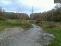
| + | Image:2012-10-06_18.18.34.jpg | Wrong turn, another trail. | ||
| + | |||
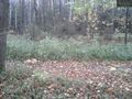
| + | Image:2012-10-06 18.28 599.jpg | Strange disfigured tree near the hash. | ||
| + | |||
| + | Image:2012-10-06 18.33 600.jpg | GPS number was always changing. | ||
| + | |||
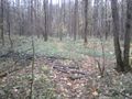
| + | Image:2012-10-06 18.36 608.jpg | Trying to look natural. | ||
| + | |||
| + | Image:2012-10-06 18.37 609.jpg | At the point. | ||
| + | |||
| + | Image:2012-10-06 18.37 610.jpg | At the point. | ||
| + | |||
| + | Image:2012-10-06 18.41 611.jpg | At the point. | ||
| + | |||
| + | Image:2012-10-06 18.44 616.jpg | Back at the wrong trail. | ||
| + | |||
| + | Image:2012-10-06 18.48 617.jpg | Back at the right trail. | ||
| + | |||
| + | Image:2012-10-06 19.09 619.jpg | Back at the road. | ||
| + | |||
</gallery> | </gallery> | ||
| Line 53: | Line 83: | ||
<!-- =============== USEFUL CATEGORIES FOLLOW ================ | <!-- =============== USEFUL CATEGORIES FOLLOW ================ | ||
Delete the next line ONLY if you have chosen the appropriate categories below. If you are unsure, don't worry. People will read your report and help you with the classification. --> | Delete the next line ONLY if you have chosen the appropriate categories below. If you are unsure, don't worry. People will read your report and help you with the classification. --> | ||
| − | |||
| − | |||
| − | |||
| − | |||
| − | |||
| − | |||
| − | |||
[[Category:Expeditions]] | [[Category:Expeditions]] | ||
| − | |||
[[Category:Expeditions with photos]] | [[Category:Expeditions with photos]] | ||
| − | |||
| − | |||
| − | |||
| − | |||
[[Category:Coordinates reached]] | [[Category:Coordinates reached]] | ||
| − | + | [[Category:Public transport geohash achievement]] | |
| − | |||
| − | |||
| − | |||
| − | |||
| − | |||
| − | |||
| − | |||
| − | |||
| − | |||
| − | |||
| − | |||
| − | |||
| − | |||
| − | |||
| − | [[Category: | ||
| − | |||
| − | |||
Revision as of 22:50, 6 October 2012
| Sat 6 Oct 2012 in 55,37: 55.8559654, 37.7559718 geohashing.info google osm bing/os kml crox |
Location
In Losiny Ostrov National Park.
Participants
Plans
The hash is about 100m from the nearest trail, about 3km into the woods from the entrance to the park, which is about 2.5km from the nearest Metro station. About a half of the trail to the hash is concrete road.
Expedition
Leaving home noticed that my android phone is almost discharged. Charging took time, so I left later than expected. Last 100m off the trail took long time also, so when I got to the hash it was almost dark.
GPS couldn't decide where exactly am I, showing me some random constantly changing numbers, so it is really within a precision.
Android still phone died almost exactly after I reached the hash, so I continued with the symbian one.
Left at the hash semi-deflated balloon that I found near the trail earlier.
Tracklog
Photos
Entering Losiniy ostrov @55.8298,37.7644
End of the road @55.8417,37.7629
Leaving the trail @55.8564,37.7600
Wrong turn, another trail.
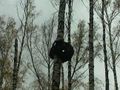
Strange disfigured tree near the hash.

GPS number was always changing.

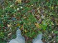
Trying to look natural.
At the point.

At the point.

At the point.
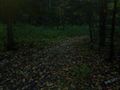
Back at the wrong trail.
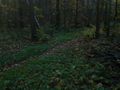
Back at the right trail.
Back at the road.


