Difference between revisions of "2012-10-06 55 37"
imported>Vb (→Achievements) |
imported>FippeBot m (Location) |
||
| (3 intermediate revisions by one other user not shown) | |||
| Line 35: | Line 35: | ||
GPS couldn't decide where exactly am I, showing me some random constantly changing numbers, so it is really within a precision. | GPS couldn't decide where exactly am I, showing me some random constantly changing numbers, so it is really within a precision. | ||
| − | Android | + | Android phone died almost exactly after I reached the hash, so I continued with the symbian one. |
Left at the hash semi-deflated balloon that I found near the trail earlier. | Left at the hash semi-deflated balloon that I found near the trail earlier. | ||
| Line 82: | Line 82: | ||
<!-- Add any achievement ribbons you earned below, or remove this section --> | <!-- Add any achievement ribbons you earned below, or remove this section --> | ||
| − | + | {{consecutive geohash 2 | count = 3 | latitude = 55 | longitude = 37 | date = 2012-10-05 | name = [[User:Vb|vb]] }} | |
| − | |||
| − | |||
[[Category:Expeditions]] | [[Category:Expeditions]] | ||
[[Category:Expeditions with photos]] | [[Category:Expeditions with photos]] | ||
| − | |||
[[Category:Coordinates reached]] | [[Category:Coordinates reached]] | ||
| + | [[Category:Land geohash achievement]] | ||
[[Category:Public transport geohash achievement]] | [[Category:Public transport geohash achievement]] | ||
| − | [[Category: Consecutive geohash achievement]] | + | [[Category:Consecutive geohash achievement]] |
| + | {{location|RU|MOW}} | ||
Latest revision as of 06:26, 13 August 2019
| Sat 6 Oct 2012 in 55,37: 55.8559654, 37.7559718 geohashing.info google osm bing/os kml crox |
Location
In Losiny Ostrov National Park.
Participants
Plans
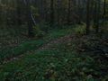
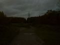
The hash is about 100m from the nearest trail, about 3km into the woods from the entrance to the park, which is about 2.5km from the nearest Metro station. About a half of the trail to the hash is concrete road.
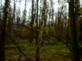
Expedition
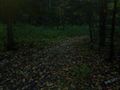
Leaving home noticed that my android phone is almost discharged. Charging took time, so I left later than expected. Last 100m off the trail took long time also, so when I got to the hash it was almost dark.
GPS couldn't decide where exactly am I, showing me some random constantly changing numbers, so it is really within a precision.
Android phone died almost exactly after I reached the hash, so I continued with the symbian one.
Left at the hash semi-deflated balloon that I found near the trail earlier.
Tracklog
Photos
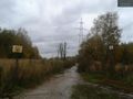
Entering Losiniy ostrov @55.8298,37.7644
End of the road @55.8417,37.7629
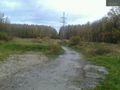
Leaving the trail @55.8564,37.7600
Wrong turn, another trail.
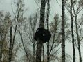
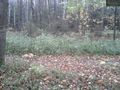
Strange disfigured tree near the hash.
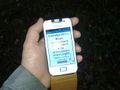
GPS numbers were constantly changing.

Trying to look natural.
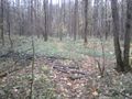
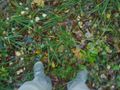
At the point.
At the point.

At the point.

At the point.
Back at the wrong trail.
Back at the right trail.
Back at the road.


Achievements
vb earned the Consecutive geohash achievement
|