Difference between revisions of "2012-10-15 55 13"
From Geohashing
imported>Mjaje (→Location) |
m |
||
| (16 intermediate revisions by 2 users not shown) | |||
| Line 24: | Line 24: | ||
<!-- who attended: If you link to your wiki user name in this section, your expedition will be picked up by the various statistics generated for geohashing. You may use three tildes ~ as a shortcut to automatically insert the user signature of the account you are editing with. | <!-- who attended: If you link to your wiki user name in this section, your expedition will be picked up by the various statistics generated for geohashing. You may use three tildes ~ as a shortcut to automatically insert the user signature of the account you are editing with. | ||
--> | --> | ||
| + | [[User:Mjaje|Mjaje]] | ||
== Plans == | == Plans == | ||
<!-- what were the original plans --> | <!-- what were the original plans --> | ||
| + | The plans started this morning when driving to work, and I saw that I was driving away from the place. | ||
| + | Then I realized that it was very close to home. I will visit the place this evening. | ||
== Expedition == | == Expedition == | ||
<!-- how it all turned out. your narrative goes here. --> | <!-- how it all turned out. your narrative goes here. --> | ||
| + | After work and driving the kids to thait scout activites and then picking them up and getting them to bed, I could go on my first geohash expedition. | ||
| + | I started at my house and walked the 180 meters to the geohash, I actually live 125 meters from it. | ||
| + | As it is a neighbour it was not hard to give them a call and to get their approval for going there. | ||
| + | |||
| + | At the spot I took some photo of my mobile, and a dark photo of myself and the GPS. | ||
== Tracklog == | == Tracklog == | ||
| Line 36: | Line 44: | ||
== Photos == | == Photos == | ||
<!-- Insert pictures between the gallery tags using the following format: | <!-- Insert pictures between the gallery tags using the following format: | ||
| − | Image:2012- | + | Image:2012-10-15-55-13-01-gpsen.png | I did it.--> |
| − | --> | ||
<gallery perrow="5"> | <gallery perrow="5"> | ||
| + | Image:2012-10-15-55-13-01-gpsen.png | My gps. | ||
| + | Image:2012-10-15-55-13-02-fotot.png | Me with gps. | ||
| + | Image:Geohasher-app1.png | I did it. | ||
</gallery> | </gallery> | ||
| Line 46: | Line 56: | ||
| − | + | {{land geohash | |
| − | + | | latitude = 55 | |
| − | [[ | + | | longitude = 13 |
| + | | date = 2012-10-15 | ||
| + | | name = [[User:Mjaje|Mjaje]] | ||
| + | }} | ||
| + | |||
| + | {{Ambassador geohash | ||
| + | | latitude = 55 | ||
| + | | longitude = 13 | ||
| + | | date = 2012-10-15 | ||
| + | | granter = Nils | ||
| + | | name = [[User:Mjaje|Mjaje]] | ||
| + | }} | ||
| + | |||
| + | {{couch potato geohash | ||
| + | |||
| + | | latitude = 55 | ||
| + | | longitude = 13 | ||
| + | | date = 2012-10-15 | ||
| + | | name = [[User:Mjaje|Mjaje]] | ||
| + | | honor = true }} | ||
| − | + | {{Walk geohash | |
| − | + | | latitude = 55 | |
| − | [[ | + | | longitude = 13 |
| − | + | | date = 2012-10-15 | |
| + | | name = [[User:Mjaje|Mjaje]] | ||
| + | }} | ||
| − | |||
[[Category:Expeditions]] | [[Category:Expeditions]] | ||
| − | |||
[[Category:Expeditions with photos]] | [[Category:Expeditions with photos]] | ||
| − | |||
| − | |||
| − | |||
| − | |||
| − | |||
[[Category:Coordinates reached]] | [[Category:Coordinates reached]] | ||
| − | + | {{location|SE|M}} | |
| − | |||
| − | |||
| − | |||
| − | |||
| − | |||
| − | |||
| − | |||
| − | |||
| − | |||
| − | |||
| − | |||
| − | |||
| − | |||
| − | |||
| − | |||
| − | |||
| − | |||
Latest revision as of 10:28, 22 September 2021
| Mon 15 Oct 2012 in 55,13: 55.4538044, 13.1561817 geohashing.info google osm bing/os kml crox |
Location
Beside a modern barn on someones property, in Stora Slågarp, Skåne, Sweden.
Participants
Plans
The plans started this morning when driving to work, and I saw that I was driving away from the place. Then I realized that it was very close to home. I will visit the place this evening.
Expedition
After work and driving the kids to thait scout activites and then picking them up and getting them to bed, I could go on my first geohash expedition. I started at my house and walked the 180 meters to the geohash, I actually live 125 meters from it. As it is a neighbour it was not hard to give them a call and to get their approval for going there.
At the spot I took some photo of my mobile, and a dark photo of myself and the GPS.
Tracklog
Photos
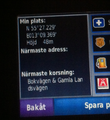
My gps.

Me with gps.
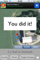
I did it.


Achievements
Mjaje earned the Land geohash achievement
|
Mjaje earned the Ambassador achievement
|

Mjaje earned the Couch Potato Geohash Honorable Mention
by living near the (55, 13) geohash on 2012-10-15.
Mjaje earned the Walk geohash Achievement
|