Difference between revisions of "2012-12-23 55 37"
From Geohashing
imported>Vb (→Expedition) |
imported>Vb (→Tracklog) |
||
| Line 39: | Line 39: | ||
== Tracklog == | == Tracklog == | ||
<!-- if your GPS device keeps a log, you may post a link here --> | <!-- if your GPS device keeps a log, you may post a link here --> | ||
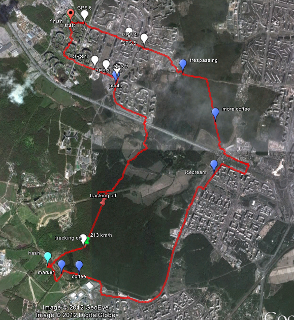
| + | [[File:2012-12-23_55_37_vb.png]] | ||
| + | |||
| + | http://en.wikiloc.com/wikiloc/view.do?id=3794074 | ||
== Photos == | == Photos == | ||
Revision as of 17:30, 31 December 2012
| Sun 23 Dec 2012 in 55,37: 55.5585921, 37.5100048 geohashing.info google osm bing/os kml crox |
Location
Near the edge of Butovskiy forest park, not far away from 2012-09-17 55 37 hash.
Participants
Plans
Weather forecast -22 .. -25 C, partly cloudy.
Expedition
The temperature was about -20 C.
The plan was to walk from home to hash, trough Yasenevo and Butovskiy forest park, then get to the nearest Metro station in South Butovo. But when I reached Butovo, I didn't feel tired yet, nor too cold, and I decided to walk back home too, thus passing by the border of South and North Butovo, through Bitsevskiy forest park and Yasenevo again, completing Tron cycle.
Tracklog and a bit more detailed description will be in a couple of days.
Tracklog
http://en.wikiloc.com/wikiloc/view.do?id=3794074
