Difference between revisions of "2013-02-25 60 22"
imported>Suurnesu ([live picture] Full moon [http://www.openstreetmap.org/?lat=60.37580000&lon=22.21770000&zoom=16&layers=B000FTF @60.3758,22.2177]) |
imported>FippeBot m (Location) |
||
| (3 intermediate revisions by one other user not shown) | |||
| Line 18: | Line 18: | ||
__NOTOC__ | __NOTOC__ | ||
== Location == | == Location == | ||
| − | + | Between islands, Satava and Kakskerta in Turku | |
== Participants == | == Participants == | ||
| − | |||
| − | |||
| − | + | * [[User:Suurnesu|Suurnesu]] | |
| − | |||
== Expedition == | == Expedition == | ||
| − | + | At first glance I was disappointed because the hashpoint was in the sea. Then, I realized that "Hey! It is winter and the sea is Frozen!" The location was not far from the shore and only some 5 km from my home. In the evening I drove to the island of Satava. I left my car in front of "Satavan kyläkauppa", small and personal shop, which also has a cafe. | |
| + | |||
| + | I was prepared with ice picks but this was not necessary. There were fresh snowmobile tracks on the ice and no water could be seen even in the very shore. There was about 20 cm snow on the ice so it wasn't too hard to walk 50 meters to the hashpoint. | ||
| + | |||
| + | There was a beautiful full moon, so it wasn't very dark. I took some pictures with my Samsung xCover, but since it is not the best possible camera, it seems that it was dark although it really wasn't. | ||
| − | + | This was first geohash on ice for me! Great! | |
| − | |||
== Photos == | == Photos == | ||
| Line 40: | Line 40: | ||
Image:2013-02-25_60_22_20-52-33-839.jpg | Full moon [http://www.openstreetmap.org/?lat=60.37580000&lon=22.21770000&zoom=16&layers=B000FTF @60.3758,22.2177] | Image:2013-02-25_60_22_20-52-33-839.jpg | Full moon [http://www.openstreetmap.org/?lat=60.37580000&lon=22.21770000&zoom=16&layers=B000FTF @60.3758,22.2177] | ||
| + | |||
| + | Image:2013-02-25_60_22_21-12-40-491.jpg | Satavan kyläkauppa -shop [http://www.openstreetmap.org/?lat=60.37580000&lon=22.21780000&zoom=16&layers=B000FTF @60.3758,22.2178] | ||
| + | |||
| + | Image:2013-02-25_60_22_21-13-41-221.jpg | Happy geohasher on ice [http://www.openstreetmap.org/?lat=60.37570000&lon=22.21760000&zoom=16&layers=B000FTF @60.3757,22.2176] | ||
</gallery> | </gallery> | ||
| Line 46: | Line 50: | ||
<!-- Add any achievement ribbons you earned below, or remove this section --> | <!-- Add any achievement ribbons you earned below, or remove this section --> | ||
| + | {{walking on water geohash | latitude = 60 | longitude = 22 | date = 2013-02-25 | name = [[User:suurnesu|suurnesu]] }} | ||
| − | |||
| − | |||
| − | |||
| − | |||
| − | |||
| − | |||
| − | |||
| − | |||
| − | |||
[[Category:Expeditions]] | [[Category:Expeditions]] | ||
| − | + | [[Category:Expeditions with photos]] | |
| − | [[Category:Expeditions with photos]] | ||
| − | |||
| − | |||
| − | |||
| − | |||
| − | |||
[[Category:Coordinates reached]] | [[Category:Coordinates reached]] | ||
| − | + | {{location|FI|19}} | |
| − | |||
| − | |||
| − | |||
| − | |||
| − | |||
| − | |||
| − | |||
| − | |||
| − | |||
| − | |||
| − | |||
| − | |||
| − | |||
| − | |||
| − | |||
| − | |||
| − | |||
Latest revision as of 01:08, 14 August 2019
| Mon 25 Feb 2013 in 60,22: 60.3757303, 22.2176526 geohashing.info google osm bing/os kml crox |
Location
Between islands, Satava and Kakskerta in Turku
Participants
Expedition
At first glance I was disappointed because the hashpoint was in the sea. Then, I realized that "Hey! It is winter and the sea is Frozen!" The location was not far from the shore and only some 5 km from my home. In the evening I drove to the island of Satava. I left my car in front of "Satavan kyläkauppa", small and personal shop, which also has a cafe.
I was prepared with ice picks but this was not necessary. There were fresh snowmobile tracks on the ice and no water could be seen even in the very shore. There was about 20 cm snow on the ice so it wasn't too hard to walk 50 meters to the hashpoint.
There was a beautiful full moon, so it wasn't very dark. I took some pictures with my Samsung xCover, but since it is not the best possible camera, it seems that it was dark although it really wasn't.
This was first geohash on ice for me! Great!
Photos
Full moon @60.3758,22.2177
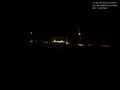
Satavan kyläkauppa -shop @60.3758,22.2178
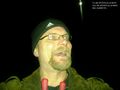
Happy geohasher on ice @60.3757,22.2176


Achievements
suurnesu earned the Walking on water geohash achievement
|