Difference between revisions of "2013-03-09 1 103"
imported>Vermouthandgin |
imported>FippeBot m (Location) |
||
| (2 intermediate revisions by one other user not shown) | |||
| Line 39: | Line 39: | ||
<!-- Insert pictures between the gallery tags using the following format: | <!-- Insert pictures between the gallery tags using the following format: | ||
| − | + | ||
--> | --> | ||
<gallery perrow="5"> | <gallery perrow="5"> | ||
| + | image: Hashpoint Coordinates.png|2013-03-09 Singapore | ||
| + | |||
| + | Image:Start 1.jpg| Get start | ||
| + | |||
| + | Image:Hall 8 bus station 1.jpg| Bus stop Hall 8, Waiting for 199 | ||
| + | image: Chinese temple 1.jpg|Chinese temple near Sheng Siong | ||
| + | image: Bus 193 1.jpg | here comes 193 | ||
| + | image: Station nearby 1.jpg|near the hashpoint | ||
| + | image: Street nearby 1.jpg| near the hashpoint | ||
| + | |||
| + | image: Hashpoint 1.jpg| | ||
| + | image: GPS.png|Reach it!!! | ||
| + | image: Date 1.jpg| Since I forgot to bring another device to show the date, i borrowed the phone of the truck driver. However, I moved a little bit to reach his truck. | ||
| + | image: At the point.jpg|near the point | ||
| + | |||
| + | |||
</gallery> | </gallery> | ||
== Achievements == | == Achievements == | ||
{{#vardefine:ribbonwidth|800px}} | {{#vardefine:ribbonwidth|800px}} | ||
| − | |||
| + | {{Public transport geohash|latitude=1|longitude=103|date=2013-03-09|name=[[User:vermouthandgin|vermouthandgin]]}} | ||
| − | |||
| − | |||
| − | |||
| − | |||
| − | |||
| − | |||
| − | |||
| − | |||
| − | |||
[[Category:Expeditions]] | [[Category:Expeditions]] | ||
| − | |||
[[Category:Expeditions with photos]] | [[Category:Expeditions with photos]] | ||
| − | |||
| − | |||
| − | |||
| − | |||
| − | |||
[[Category:Coordinates reached]] | [[Category:Coordinates reached]] | ||
| − | + | {{location|SG|SW}} | |
| − | |||
| − | |||
| − | |||
| − | |||
| − | |||
| − | |||
| − | |||
| − | |||
| − | |||
| − | |||
| − | |||
| − | |||
| − | |||
| − | |||
| − | |||
| − | |||
| − | |||
Latest revision as of 01:20, 14 August 2019
| Sat 9 Mar 2013 in 1,103: 1.3306481, 103.6416891 geohashing.info google osm bing/os kml crox |
Location
On the street in Jurong Industry estate.
Participants
Plans
This is the first hashpoint, where really locate inside Singapore main-island and is also reachable, since I came back Singapore(1st of March). Try to reach the hashpoint only by public transportation.
Expedition
After Checking the Hashpoint with Zertrin, I decided to visit this hashpoint on Saturday between collect my old stuffs from friend and the dinner later with other friends. Since this is my first hashpoint, I need to download GPS application and all other necessary applications. With Zertrin's help, I selected Geohashing and GPS Data these two applications.
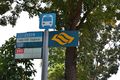
Woke up near 12pm, got out really in a rush. First of all, I needed to meet a friend at student apartment near Sheng Siong market,by taking Bus 199 from hall 8 to Blk 271 CP. After collected my stuffs, I walked forward to the bus station Blk 673C to take Bus 193. However, I was on the wrong side of the road, since in Singapore driving on left. Moreover, the temperature is 30 degree, which almost killed me, but based on the weather report, there will be a heavy rain in the afternoon. During I was waiting bus 193, I found the cost for public transportation is really cheap if you hold any kinds of transportation card. Finally, I reached the station Opp CHC Express which is near the hashpoint. By 5 mins walking I found the exactly hashpoint.
On the way back, it started rain. I took bus 193 to Boon Lay interchange, then one station from Boon Lay to Pioneer by MRT and from the station back to hall 8 by University shuttle bus line D.
Photos

2013-03-09 Singapore
Get start
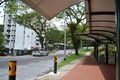
Bus stop Hall 8, Waiting for 199

Chinese temple near Sheng Siong

here comes 193
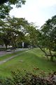
near the hashpoint
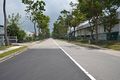
near the hashpoint

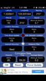
Reach it!!!

Since I forgot to bring another device to show the date, i borrowed the phone of the truck driver. However, I moved a little bit to reach his truck.

near the point


Achievements
vermouthandgin earned the Public transport geohash achievement
|