Difference between revisions of "2013-04-17 50 8"
From Geohashing
imported>Yakamoz (→Photos) |
imported>Yakamoz (→Photos) |
||
| Line 26: | Line 26: | ||
Image:2013-04-17_50_8_distance.png| A long way from my home to the hashpoint | Image:2013-04-17_50_8_distance.png| A long way from my home to the hashpoint | ||
Image:2013-04-17_50_8_finish.png| Almost a finish | Image:2013-04-17_50_8_finish.png| Almost a finish | ||
| − | Image:2013-04-17_50_8_geohashpoint. | + | Image:2013-04-17_50_8_geohashpoint.JPG| Geohashpoint |
Image:2013-04-17_50_8_barracks.JPG| A view to barracks | Image:2013-04-17_50_8_barracks.JPG| A view to barracks | ||
Revision as of 19:21, 17 April 2013
| Wed 17 Apr 2013 in 50,8: 50.5891163, 8.7053953 geohashing.info google osm bing/os kml crox |
Location
Former US Army barracks on Hannah Arendt Street in Gießen.
Participants
Plans
I saw yesterday that the today's geohash has been very close to my home. So I decided quickly to go geohashing before or after work.
Expedition
This geohash was very easy for me. I know this destrict because I live here. So It didn't take me long to find the geohashpoint and take some photos... PS: The navigation function of my smartphone isn't exact. That's why the closest screenshot shows 1 m distance.
Photos
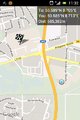
A long way from my home to the hashpoint
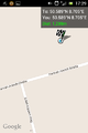
Almost a finish
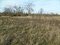
Geohashpoint
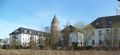
A view to barracks


Achievements
Yakamoz earned the Land geohash achievement
|