Difference between revisions of "2013-04-23 40 -86"
imported>Buttercup |
m |
||
| (3 intermediate revisions by 2 users not shown) | |||
| Line 18: | Line 18: | ||
It is on the south side of Purdue's campus. The satellite image shows construction, so I hope that that is an old image... Purdue always has some type of construction going on. | It is on the south side of Purdue's campus. The satellite image shows construction, so I hope that that is an old image... Purdue always has some type of construction going on. | ||
| − | |||
== Participants == | == Participants == | ||
| Line 44: | Line 43: | ||
<gallery perrow="5"> | <gallery perrow="5"> | ||
Image:2013-04-23 gps.png|GPS | Image:2013-04-23 gps.png|GPS | ||
| − | Image:2013-04-23 picture. | + | Image:2013-04-23 picture.JPG|Very windy! |
</gallery> | </gallery> | ||
| Line 50: | Line 49: | ||
{{#vardefine:ribbonwidth|800px}} | {{#vardefine:ribbonwidth|800px}} | ||
<!-- Add any achievement ribbons you earned below, or remove this section --> | <!-- Add any achievement ribbons you earned below, or remove this section --> | ||
| − | {{land geohash | latitude = 40 | longitude = -86 | date = 2013-04-23 | name = Buttercup | image = 2013-04-23 picture. | + | {{land geohash | latitude = 40 | longitude = -86 | date = 2013-04-23 | name = Buttercup | image = 2013-04-23 picture.JPG}} |
{{couch potato geohash | latitude = 40 | longitude = -86 | date = 2013-04-23 | name = Buttercup | honor = true }} | {{couch potato geohash | latitude = 40 | longitude = -86 | date = 2013-04-23 | name = Buttercup | honor = true }} | ||
{{Walk geohash | latitude = 40 | longitude = -86 | date = 2013-04-23 | name = Buttercup }} | {{Walk geohash | latitude = 40 | longitude = -86 | date = 2013-04-23 | name = Buttercup }} | ||
| + | |||
| + | [[Category:Expeditions]] | ||
| + | [[Category:Expeditions with photos]] | ||
| + | [[Category:Coordinates reached]] | ||
| + | {{location|US|IN|TP}} | ||
Latest revision as of 12:55, 22 September 2021
| Tue 23 Apr 2013 in 40,-86: 40.4205777, -86.9202896 geohashing.info google osm bing/os kml crox |
Location
It is on the south side of Purdue's campus. The satellite image shows construction, so I hope that that is an old image... Purdue always has some type of construction going on.
Participants
Plans
This one is less than a mile away from my home, so it should be an easy get! The only thing I am worried about is construction... I will walk there from my home after lunch!
Expedition
I finished my lunch and headed over to the south side of campus. It started drizzling while I walked and it got really windy. When I got near the area, I saw that the construction had been "finished" and there was now a gravel parking lot! The satellite image showed obstacles, so I was excited because I wasn't going to be blocked by a fence.
The GPS on my phone isn't the greatest, so it takes some time to figure out just exactly where I need to go. All in all, it was a nice walk and I didn't get too wet from the rain!
Photos
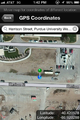
GPS

Very windy!


Achievements
Buttercup earned the Land geohash achievement
|

Buttercup earned the Walk geohash Achievement
|