Difference between revisions of "2013-05-01 47 11"
imported>LeslieHapablap (→Achievements) |
imported>LeslieHapablap (→Photos) |
||
| Line 50: | Line 50: | ||
<gallery perrow="5"> | <gallery perrow="5"> | ||
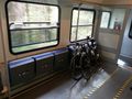
| − | Image:2013-05-01 47 11 waltraud.jpg | Waltraud stored for the ride. | + | Image:2013-05-01 47 11 waltraud.jpg | Waltraud stored for the ride (needed all the space we could get). |
Image:2013-05-01_47_11_15-59-50-626.jpg | EleanorAbernathy in a serpentine. | Image:2013-05-01_47_11_15-59-50-626.jpg | EleanorAbernathy in a serpentine. | ||
Revision as of 21:26, 1 May 2013
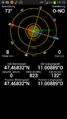
| Wed 1 May 2013 in 47,11: 47.4683166, 11.0088927 geohashing.info google osm bing/os kml crox |
Location
Woods near Grainau, Garmisch-Partenkirchen.
Participants
Plans
We plan to go by bike from Innsbruck, about 80 km and 1000 m difference in altitude. On our way back we will take the train. Not sure how long it will take and when we leave, posting updates tomorrow.
The hashpoint seems perfectly accessible in the woods near a public road.
Expedition
- We are leaving for the expedition. -- LeslieHapablap (talk) 09:26, 1 May 2013 (CEST)
- Reached the coordinates at about 14:20. We didn't leave a marker this time because we were in a hurry to catch our train. Now on our way back to Innsbruck just in time before the rain started. -- LeslieHapablap (talk) 15:52, 1 May 2013 (CEST)
Tracklog
Our Track.
Photos
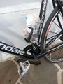
Waltraud stored for the ride (needed all the space we could get).
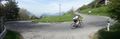
EleanorAbernathy in a serpentine.
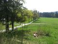
Near the highest point of the tour.
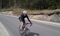
LeslieHapablap on the road.
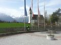
Yep, we are in Bavaria.
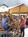
Our lunch.
Approaching the hashpoint.
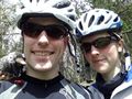
Obligatory stupid grin by happy geohashers, with Waltraud the hashcot.
Waltraud sitting at the exact spot.
Obligatory proof.
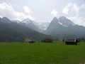
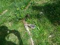
View from the hashpoint.
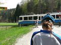
Zugspitzbahn passing the hashpoint.
Our bikes are tired too.


Achievements
EleanorAbernathy and LeslieHapablap earned the Bicycle geohash achievement
|
EleanorAbernathy and LeslieHapablap earned the Public transport geohash achievement
|
EleanorAbernathy and LeslieHapablap earned the Border geohash achievement
|