2013-05-01 47 11

| Wed 1 May 2013 in 47,11: 47.4683166, 11.0088927 geohashing.info google osm bing/os kml crox |
Location
Woods near Grainau, Garmisch-Partenkirchen.
Participants
Plans
We plan to go by bike from Innsbruck, about 80 km and 1000 m difference in altitude. On our way back we will take the train. Not sure how long it will take and when we leave, posting updates tomorrow.
The hashpoint seems perfectly accessible in the woods near a public road.
Expedition
- We are leaving for the expedition. -- LeslieHapablap (talk) 09:26, 1 May 2013 (CEST)
- Reached the coordinates at about 14:20. We didn't leave a marker this time because we were in a hurry to catch our train. Now on our way back to Innsbruck just in time before the rain started. -- LeslieHapablap (talk) 15:52, 1 May 2013 (CEST)
This was even more fun than our first expedition. This time I decided to try the navigation feature of my Garmin Forerunner 305 for the first time. By uploading the planned route to the device and following it from one way point to the next it is really easy to find the right way without having to stop to look at a map.
The main road up to Seefeld is closed for bikes so we had to take a detour of a few kilometers via Telfs and Mösern. The first 22 km were rising only slightly, followed by a 10 km climb to 1300 m a.s.l. With the long winter and this being the first serious tour this year we didn't rush at all, took our time and enjoyed the sun and the beautiful views. After reaching the highest point at km 32 we knew the worst part was over and we could basically let it roll down to Garmisch-Partenkirchen.
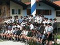
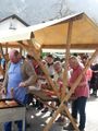
In Mittenwald we stopped for lunch (Bavarian Bratwurst) at the local first of May festivities.
After reaching and finding the coordinates without much trouble we didn't linger too long and went back to Garmisch to catch our train home. On arrival at the station we had made a total distance of 90 km. Even that we had to pay twice for our bikes in the train (for the German and the Austrian part of the trip) couldn't dampen our spirit on this very successful expedition.
Tracklog
Our Track.
Photos
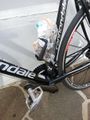
Waltraud stored for the ride (needed all the space we could get).
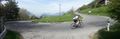
EleanorAbernathy in a serpentine.
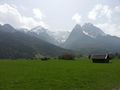
Near the highest point of the tour.
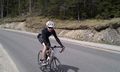
LeslieHapablap on the road.
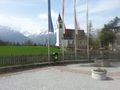
Yep, we are in Bavaria.
Our lunch.
Approaching the hashpoint.
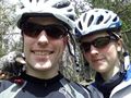
Obligatory stupid grin by happy geohashers, with Waltraud the hashcot.
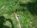
Waltraud sitting at the exact spot.
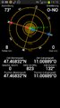
Obligatory proof.
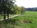
View from the hashpoint.
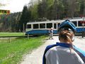
Zugspitzbahn passing the hashpoint.
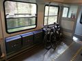
Our bikes are tired too.
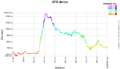
Elevation profile.


Achievements
EleanorAbernathy and LeslieHapablap earned the Public transport geohash achievement
|
EleanorAbernathy and LeslieHapablap earned the Border geohash achievement
|