Difference between revisions of "2013-05-19 52 5"
imported>Eupeodes |
imported>Eupeodes |
||
| Line 18: | Line 18: | ||
__NOTOC__ | __NOTOC__ | ||
== Location == | == Location == | ||
| − | In the forest around Wekeromse Zand | + | In the forest around Wekeromse Zand according to google maps |
<!-- where you've surveyed the hash to be --> | <!-- where you've surveyed the hash to be --> | ||
| Line 31: | Line 31: | ||
== Expedition == | == Expedition == | ||
| − | + | Cycled there, walked the route of [http://coord.info/GC11CZR Geocache Wicherum] and found the cache. I hoped it to be close to the hash to get a hash collision, but it turned to be 840 meters trough the forest and over hills. On my way to the hash I spotted some mouflon but those where to fast to take a picture of. Now I continued to the hash and surprisingly I walked out of the forest (while the gps still indicated forest). On the location I took some pictures and made a marker in the sand. On my way back I found a sign indicating that to keep the sand shifting some forest had been removed. | |
| − | |||
== Tracklog == | == Tracklog == | ||
| + | Might follow | ||
<!-- if your GPS device keeps a log, you may post a link here --> | <!-- if your GPS device keeps a log, you may post a link here --> | ||
== Photos == | == Photos == | ||
| − | + | ||
| − | |||
| − | |||
<gallery perrow="5"> | <gallery perrow="5"> | ||
| + | Image:2013-05-19_52_5_proof.jpg | Proof | ||
| + | Image:2013-05-19_52_5_grin.jpg | Grin | ||
| + | Image:2013-05-19_52_5_marker.jpg | Marker | ||
| + | Image:2013-05-19_52_5_view.jpg | The open view | ||
| + | Image:2013-05-19_52_5_ah_forest_gone.jpg | Sign about removal of forest | ||
</gallery> | </gallery> | ||
| Line 47: | Line 50: | ||
<!-- Add any achievement ribbons you earned below, or remove this section --> | <!-- Add any achievement ribbons you earned below, or remove this section --> | ||
| − | |||
| − | |||
| − | |||
| − | |||
| − | |||
| − | |||
| − | |||
| − | |||
| − | |||
| − | |||
| − | |||
[[Category:Expeditions]] | [[Category:Expeditions]] | ||
| − | |||
[[Category:Expeditions with photos]] | [[Category:Expeditions with photos]] | ||
| − | |||
| − | |||
| − | |||
| − | |||
| − | |||
[[Category:Coordinates reached]] | [[Category:Coordinates reached]] | ||
| − | + | [[Category:Eupeodes]] | |
| − | |||
| − | |||
| − | |||
| − | |||
| − | |||
| − | |||
| − | |||
| − | |||
| − | |||
| − | |||
| − | |||
| − | |||
| − | |||
| − | |||
| − | [[Category: | ||
| − | |||
| − | |||
Revision as of 18:38, 19 May 2013
| Sun 19 May 2013 in 52,5: 52.1036379, 5.6840838 geohashing.info google osm bing/os kml crox |
Location
In the forest around Wekeromse Zand according to google maps
Participants
Plans
Go there and visit some geocaches as well (might be hash collision)
Expedition
Cycled there, walked the route of Geocache Wicherum and found the cache. I hoped it to be close to the hash to get a hash collision, but it turned to be 840 meters trough the forest and over hills. On my way to the hash I spotted some mouflon but those where to fast to take a picture of. Now I continued to the hash and surprisingly I walked out of the forest (while the gps still indicated forest). On the location I took some pictures and made a marker in the sand. On my way back I found a sign indicating that to keep the sand shifting some forest had been removed.
Tracklog
Might follow
Photos
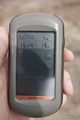
Proof

Grin
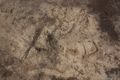
Marker
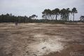
The open view
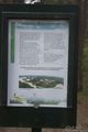
Sign about removal of forest


