Difference between revisions of "2013-06-17 65 24"
From Geohashing
imported>Koodi (→Location) |
imported>Palmpje (Set result codes) |
||
| Line 58: | Line 58: | ||
<!-- Add any achievement ribbons you earned below, or remove this section --> | <!-- Add any achievement ribbons you earned below, or remove this section --> | ||
| − | |||
| − | |||
| − | |||
| − | |||
| − | |||
| − | |||
| − | |||
| − | |||
| − | |||
| − | |||
| − | |||
[[Category:Expeditions]] | [[Category:Expeditions]] | ||
| − | |||
[[Category:Expeditions with photos]] | [[Category:Expeditions with photos]] | ||
| − | |||
| − | |||
| − | |||
| − | |||
| − | |||
[[Category:Coordinates reached]] | [[Category:Coordinates reached]] | ||
| − | |||
| − | |||
| − | |||
| − | |||
| − | |||
| − | |||
| − | |||
| − | |||
| − | |||
| − | |||
| − | |||
| − | |||
| − | |||
| − | |||
| − | |||
| − | |||
| − | |||
| − | |||
Revision as of 17:23, 17 June 2013
| Mon 17 Jun 2013 in 65,24: 65.8402857, 24.1134816 geohashing.info google osm bing/os kml crox |
Location
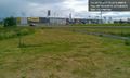
Near the traffic circle in Haparanda, Björka.
Participants
Plans
Expedition
- Near the traffic circle in Haparanda, Björka. -- koodi (talk) @65.8403,24.1137 12:12, 17 June 2013 (EDT)
Tracklog
Photos
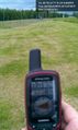
Bus stop @65.8403,24.1136
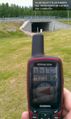
Underpass bridge @65.8403,24.1136
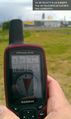
Swedol @65.8403,24.1136
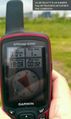
K-Rauta @65.8403,24.1136
Ööb and other @65.8404,24.1134


