Difference between revisions of "2013-06-25 47 -122"
From Geohashing
imported>Thomcat ([live picture] My kingdom for a GPS that doesn't have problems with trees! [http://www.openstreetmap.org/?lat=47.75384673&lon=-122.22505549&zoom=16&layers=B000FTF @47.7538,-122.2251]) |
imported>Thomcat ([live picture] Hi from Bothell [http://www.openstreetmap.org/?lat=47.75384723&lon=-122.22505454&zoom=16&layers=B000FTF @47.7538,-122.2251]) |
||
| Line 29: | Line 29: | ||
Image:2013-06-25_47_-122_16-43-53-180.jpg | My kingdom for a GPS that doesn't have problems with trees! [http://www.openstreetmap.org/?lat=47.75384673&lon=-122.22505549&zoom=16&layers=B000FTF @47.7538,-122.2251] | Image:2013-06-25_47_-122_16-43-53-180.jpg | My kingdom for a GPS that doesn't have problems with trees! [http://www.openstreetmap.org/?lat=47.75384673&lon=-122.22505549&zoom=16&layers=B000FTF @47.7538,-122.2251] | ||
| + | |||
| + | Image:2013-06-25_47_-122_16-45-55-209.jpg | Hi from Bothell [http://www.openstreetmap.org/?lat=47.75384723&lon=-122.22505454&zoom=16&layers=B000FTF @47.7538,-122.2251] | ||
</gallery> | </gallery> | ||
Revision as of 23:46, 25 June 2013
| Tue 25 Jun 2013 in Seattle: 47.7538188, -122.2250190 geohashing.info google osm bing/os kml crox |
Location
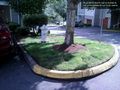
A parking strip in an apartment complex just off Bothell Way
Participants
Plans
Wasn't on the way to work, but it will be on the way home. Stop by
Expedition
Already in the commute, I punched up today's point (at a stop light of course). Geohash Android tells me Bothell, and zooming in I see it's just off Bothell Way, also known as state highway 522. This connector leads down from Highway 2 to Seattle proper, and is my favorite route to work and often to and from Eastern Washington.
- D minus 10k -- Thomcat (talk) @47.7393,-122.3504 06:35, 25 June 2013 (PDT)
Photos
My kingdom for a GPS that doesn't have problems with trees! @47.7538,-122.2251

Hi from Bothell @47.7538,-122.2251


Achievements