Difference between revisions of "2013-07-14 49 4"
imported>Beltxarga |
imported>Beltxarga |
||
| Line 34: | Line 34: | ||
== Achievements == | == Achievements == | ||
| − | {{ | + | {{Virgin graticule |
| − | |||
| + | | latitude = 49 | ||
| + | | longitude = 4 | ||
| + | | date = 2013-07-14 | ||
| + | | name = Beltxarga | ||
| − | + | }} | |
| − | |||
| − | |||
| − | |||
| − | |||
| − | |||
| − | |||
| − | |||
| − | |||
[[Category:Expeditions]] | [[Category:Expeditions]] | ||
| − | |||
[[Category:Expeditions with photos]] | [[Category:Expeditions with photos]] | ||
| − | |||
| − | |||
| − | |||
| − | |||
| − | |||
[[Category:Coordinates reached]] | [[Category:Coordinates reached]] | ||
| − | |||
| − | |||
| − | |||
| − | |||
| − | |||
| − | |||
| − | |||
| − | |||
| − | |||
| − | |||
| − | |||
| − | |||
| − | |||
| − | |||
| − | |||
| − | |||
| − | |||
| − | |||
Revision as of 10:31, 14 July 2013
| Sun 14 Jul 2013 in 49,4: 49.3604403, 4.2995779 geohashing.info google osm bing/os kml crox |
Location
A field between Ménil-Lépinois and Aussonce.
Participants
Plans
I was looking for the perfect location for my first geohash expedition. This one was in my home graticule (49,4), not too far (about 25 km from home), and it was taking place on a Sunday. Last but not least, my graticule was still virgin.
Expedition
I woke up at 8 am, a bit earlier than usual on Sundays, maybe excited by the expedition. At 9 am, I was departing from home. The weather was really nice, and I was pretty much enjoying the countryside roads... when my GPS told me I was arriving at the location. It took me a little while to find that little road on the map. I parked there, in the middle of nowhere, and started to look for the spot. I was confused and couldn't really think straight at first (I was a bit worried someone would see me, and think I'm a kind of crazy person, going around in circles, alone in a field, on the French National Day). My car SatNav wasn't really helpful (no compass, no general direction, just the raw coordinates). Did I have to walk towards North to increase the N coordinate value?! I wasn't even sure anymore. Where was North anyway? In what bloody direction could I go to change the longitude value without changing the latitude one? After relaxing a bit, I could think again, and finally found the spot, right where it was supposed to be.
On my way back, I was denied access to my own street because of a market. The man said I couldn't go, for security reasons. When I told him I lived there, he said that I should take the street in the wrong way (it's a one-way street). Hence, for the first time of my life, I took a one-way street in the wrong way for security reasons.
Photos
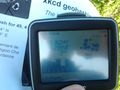
Crap picture of my GPS at the spot.
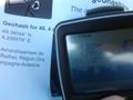
Second crap picture of my GPS at the spot.
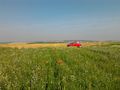
Looking NW: the little road from the spot. With red flowers and red car :)
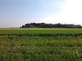
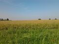
Looking NE.
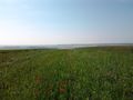
Looking SE towards Aussonce.
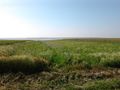
Looking SW.
The spot from the little road.
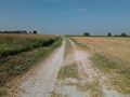
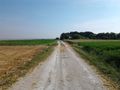
The road, looking SW.
The road, looking NE.


