Difference between revisions of "2013-08-15 48 9"
From Geohashing
imported>Hansundgrete (Created page with "2013-08-15: Hansundgrete have been on the way to visit their first geohash. == Location == in a little fir wood somewhere between tem...") |
m |
||
| (7 intermediate revisions by 4 users not shown) | |||
| Line 1: | Line 1: | ||
| + | {{meetup graticule | lat=48 | lon=9 | date=2013-08-15 }} | ||
| + | |||
[[2013-08-15 48 9|2013-08-15]]: [[User:Hansundgrete|Hansundgrete]] have been on the way to visit their first geohash. | [[2013-08-15 48 9|2013-08-15]]: [[User:Hansundgrete|Hansundgrete]] have been on the way to visit their first geohash. | ||
== Location == | == Location == | ||
| Line 5: | Line 7: | ||
[[User:Hansundgrete|Hansundgrete]] | [[User:Hansundgrete|Hansundgrete]] | ||
== Expedition == | == Expedition == | ||
| − | starting at the parking lot near the cementary in tomerdingen we took the way via a biotope for the short hike to the desired spot. the farmers harvested their fields, raptorial birds took their flying hours and additionally to taking photos we made some field recordings what the bees found very interesting. arrived at the gz we took some pictures but sadly we were so excited about our first gh we didn't make a correct photo as a log proof;-( | + | starting at the parking lot near the cementary in tomerdingen we took the way via a biotope for the short hike to the desired spot. the farmers harvested their fields, raptorial birds took their flying hours and additionally to taking photos we made some field recordings[http://aporee.org/maps/?loc=19289] what the bees found very interesting. arrived at the gz we took some pictures but sadly we were so excited about our first gh we didn't make a correct photo as a log proof;-( |
| + | |||
all in all we had a great time and we could say that this was definitely not our last geohash. | all in all we had a great time and we could say that this was definitely not our last geohash. | ||
| + | <gallery perrow="5"> File:Gh 2013-08-15 48 9.jpg | ulm,germany </gallery> | ||
| + | |||
| + | == Achievements == | ||
| + | {{land geohash | latitude = 48 | longitude = 9 | date = 2013-08-15 | name = Hansundgrete}} | ||
| + | |||
| + | [[Category:Expeditions]] | ||
| + | [[Category:Expeditions with photos]] | ||
| + | [[Category:Coordinates reached]] | ||
| + | {{location|DE|BW|UL}} | ||
Latest revision as of 13:07, 22 September 2021
| Thu 15 Aug 2013 in 48,9: 48.4968941, 9.8817539 geohashing.info google osm bing/os kml crox |
2013-08-15: Hansundgrete have been on the way to visit their first geohash.
Location
in a little fir wood somewhere between temmenhausen and tomerdingen, near ulm, south germany
Participants
Expedition
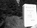
starting at the parking lot near the cementary in tomerdingen we took the way via a biotope for the short hike to the desired spot. the farmers harvested their fields, raptorial birds took their flying hours and additionally to taking photos we made some field recordings[1] what the bees found very interesting. arrived at the gz we took some pictures but sadly we were so excited about our first gh we didn't make a correct photo as a log proof;-(
all in all we had a great time and we could say that this was definitely not our last geohash.
ulm,germany

Achievements
Hansundgrete earned the Land geohash achievement
|