Difference between revisions of "2013-10-04 50 8"
From Geohashing
imported>Yakamoz ([retro picture] This is the geohash point) |
imported>Yakamoz (→Photos) |
||
| Line 22: | Line 22: | ||
== Photos == | == Photos == | ||
<gallery perrow="5"> | <gallery perrow="5"> | ||
| − | |||
| − | |||
Image:2013-10-04_50_8_20-34-29-039.jpg | Yakamoz in the geohash forest | Image:2013-10-04_50_8_20-34-29-039.jpg | Yakamoz in the geohash forest | ||
Image:2013-10-04_50_8_20-41-59-511.jpg | This is the geohash point | Image:2013-10-04_50_8_20-41-59-511.jpg | This is the geohash point | ||
</gallery> | </gallery> | ||
| + | |||
== Achievements == | == Achievements == | ||
Revision as of 18:43, 5 October 2013
| Fri 4 Oct 2013 in 50,8: 50.8522319, 8.8826887 geohashing.info google osm bing/os kml crox |
Location
In a forest, near Kirchhain (Hesse).
Participants
Plans
Rincewind went for geohashing, Yakamoz followed him :)
Expedition
Photos

Yakamoz in the geohash forest
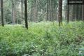
This is the geohash point


Achievements
Yakamoz and Rincewind earned the Land geohash achievement
|