Difference between revisions of "2013-10-20 52 8"
imported>GeorgDerReisende (new expedition) |
imported>FippeBot m (Location) |
||
| (3 intermediate revisions by one other user not shown) | |||
| Line 1: | Line 1: | ||
| − | |||
| − | |||
| − | |||
| − | |||
| − | |||
| − | |||
| − | |||
| − | |||
| − | |||
| − | |||
{{meetup graticule | {{meetup graticule | ||
| lat=52 | | lat=52 | ||
| Line 18: | Line 8: | ||
__NOTOC__ | __NOTOC__ | ||
== Location == | == Location == | ||
| − | + | ||
| + | The hash lies at the street Burgweg in Lohne (Oldenburg). | ||
== Participants == | == Participants == | ||
| − | + | ||
| − | + | [[User:GeorgDerReisende|GeorgDerReisende]] | |
== Plans == | == Plans == | ||
| − | + | ||
| + | I will hitchhike! Today from Kassel via Göttingen, Hannover, Nienburg and Diepholz. | ||
== Expedition == | == Expedition == | ||
| − | + | ||
| + | I left home at 11:25 and started to hitchhike at the Dresdener Straße at 12:05, after some minutes I got a lift to the service station Göttingen, where I waited about 30 minutes. This lift brought me to the service station Allertal, where I waited again for an hour, but this car brought me to the center of Verden, then I walked through the city, got then a lift to Hassel, where I waited again for an hour. With the next car I reached the national road B6 and I walked a kilometer. At that place I waited 4 hours (twenty years ago and on daylight I usually waited there five minutes for a lift to Bassum). Then at the last possible minute I got a lift to Vechta and this driver brought me to Lohne, where I arrived at 23:42 with 1.36 kilometers away from the hash. I walked to the hash and arrived there at 23:56 and stayed there for midnight. | ||
| + | |||
| + | Then I looked for a shelter to spend there the night. That one which my Garmin showed was three kilometers away, but after 500 meters I have found a small one. The next morning I decided not to go to the wanted hashes at 2013-10-21 50 6 (Lechenich), 2013-10-21 50 7 (Hövels) and 2013-10-21 50 8 (Marburg), but to go home directly. I had to wait at the service station Tecklenburger Land for one hour and at the service station Münsterland for two hours. At the service station Lichtendorf I waited for another two hours, and no driver told me to drive to Kassel. During this waiting time two groups of hitchhikers to Hannover passed, a group of two and a group of three. Then I decided to spend the night there/nearby. I found a nice looking place in a forest. | ||
| + | |||
| + | The second morning (Tuesday) I found me beyond autumn colored leaves. I stayed at this beautiful place until noon. Then I started my jouney home and arrived there at 17:15. | ||
== Tracklog == | == Tracklog == | ||
| Line 34: | Line 31: | ||
== Photos == | == Photos == | ||
| − | |||
| − | |||
| − | |||
<gallery perrow="5"> | <gallery perrow="5"> | ||
| + | Image:2013-10-20 52 8 GeorgDerReisende 1905.jpg | Vechta | ||
| + | Image:2013-10-20 52 8 GeorgDerReisende 1930.jpg | Arrival in Lohne | ||
| + | Image:2013-10-20 52 8 GeorgDerReisende 1931.JPG | proof of hash | ||
| + | Image:2013-10-20 52 8 GeorgDerReisende 1936.JPG | midnight | ||
| + | Image:2013-10-20 52 8 GeorgDerReisende 1937.jpg | the moon behind a tree at the Burgweg | ||
| + | Image:2013-10-20 52 8 GeorgDerReisende 1942.JPG | Burgweg in Lohne (Oldbg.) | ||
| + | Image:2013-10-20 52 8 GeorgDerReisende 1944.JPG | the hash | ||
| + | Image:2013-10-20 52 8 GeorgDerReisende 1950.jpg | grin | ||
| + | Image:2013-10-20 52 8 GeorgDerReisende 1956.jpg | a late (or early) meal | ||
| + | Image:2013-10-20 52 8 GeorgDerReisende 1958.JPG | the big night latern | ||
| + | Image:2013-10-20 52 8 GeorgDerReisende 1972.jpg | the first look into the morning at Lohne | ||
| + | Image:2013-10-20 52 8 GeorgDerReisende 2041.jpg | the first look into the morning at Dortmund-Lichtendorf | ||
| + | Image:2013-10-20 52 8 GeorgDerReisende 2044.jpg | a second look | ||
</gallery> | </gallery> | ||
== Achievements == | == Achievements == | ||
{{#vardefine:ribbonwidth|800px}} | {{#vardefine:ribbonwidth|800px}} | ||
| − | |||
| + | [[2013-10-20 52 8]], at the street Burgweg in Lohne (Oldenburg). | ||
| − | + | {{Thumbs Up | latitude = 52 | longitude = 8 | date = 2013-10-20 | name = GeorgDerReisende }} | |
| − | |||
| − | |||
| − | + | {{Midnight geohash | latitude = 52 | longitude = 8 | date = 2013-10-20 | name = GeorgDerReisende }} | |
| − | |||
| − | |||
| − | |||
| − | |||
[[Category:Expeditions]] | [[Category:Expeditions]] | ||
| − | + | ||
[[Category:Expeditions with photos]] | [[Category:Expeditions with photos]] | ||
| − | + | ||
| − | |||
| − | |||
| − | |||
| − | |||
[[Category:Coordinates reached]] | [[Category:Coordinates reached]] | ||
| − | + | {{location|DE|NI|VEC}} | |
| − | |||
| − | |||
| − | |||
| − | |||
| − | |||
| − | |||
| − | |||
| − | |||
| − | |||
| − | |||
| − | |||
| − | |||
| − | |||
| − | |||
| − | |||
| − | |||
| − | |||
Latest revision as of 04:23, 14 August 2019
| Sun 20 Oct 2013 in 52,8: 52.6560083, 8.2360833 geohashing.info google osm bing/os kml crox |
Location
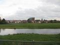
The hash lies at the street Burgweg in Lohne (Oldenburg).
Participants
Plans
I will hitchhike! Today from Kassel via Göttingen, Hannover, Nienburg and Diepholz.
Expedition
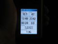
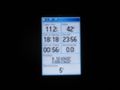
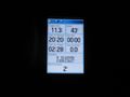
I left home at 11:25 and started to hitchhike at the Dresdener Straße at 12:05, after some minutes I got a lift to the service station Göttingen, where I waited about 30 minutes. This lift brought me to the service station Allertal, where I waited again for an hour, but this car brought me to the center of Verden, then I walked through the city, got then a lift to Hassel, where I waited again for an hour. With the next car I reached the national road B6 and I walked a kilometer. At that place I waited 4 hours (twenty years ago and on daylight I usually waited there five minutes for a lift to Bassum). Then at the last possible minute I got a lift to Vechta and this driver brought me to Lohne, where I arrived at 23:42 with 1.36 kilometers away from the hash. I walked to the hash and arrived there at 23:56 and stayed there for midnight.
Then I looked for a shelter to spend there the night. That one which my Garmin showed was three kilometers away, but after 500 meters I have found a small one. The next morning I decided not to go to the wanted hashes at 2013-10-21 50 6 (Lechenich), 2013-10-21 50 7 (Hövels) and 2013-10-21 50 8 (Marburg), but to go home directly. I had to wait at the service station Tecklenburger Land for one hour and at the service station Münsterland for two hours. At the service station Lichtendorf I waited for another two hours, and no driver told me to drive to Kassel. During this waiting time two groups of hitchhikers to Hannover passed, a group of two and a group of three. Then I decided to spend the night there/nearby. I found a nice looking place in a forest.
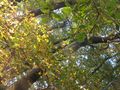
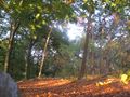
The second morning (Tuesday) I found me beyond autumn colored leaves. I stayed at this beautiful place until noon. Then I started my jouney home and arrived there at 17:15.
Tracklog
Photos
Vechta
Arrival in Lohne
proof of hash
midnight
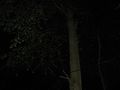
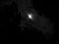
the moon behind a tree at the Burgweg
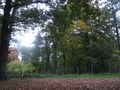
Burgweg in Lohne (Oldbg.)

the hash
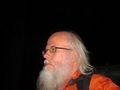
grin
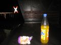
a late (or early) meal
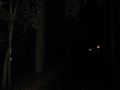
the big night latern
the first look into the morning at Lohne
the first look into the morning at Dortmund-Lichtendorf
a second look


Achievements
2013-10-20 52 8, at the street Burgweg in Lohne (Oldenburg).
GeorgDerReisende earned the Thumbs Up Geohash Achievement
|
GeorgDerReisende earned the Midnight Geohash achievement
|