Difference between revisions of "2013-12-11 40 -74"
From Geohashing
imported>Jevanyn ([live] Short version of the story: left work, followed GPS directions to geohash, took pictures. There was no signal where I was, so I didn't have driving directions home. I had a map, so I figured I'd go back to the road, turn left three times and get...) |
imported>FippeBot m (Location) |
||
| (2 intermediate revisions by one other user not shown) | |||
| Line 18: | Line 18: | ||
__NOTOC__ | __NOTOC__ | ||
== Location == | == Location == | ||
| − | + | Laurel Lane, Chester | |
== Participants == | == Participants == | ||
| − | + | [[User:Jevanyn|Jevanyn]] ([[User talk:Jevanyn|talk]]) | |
| − | |||
== Plans == | == Plans == | ||
| − | + | Originally, it was a quick side trip as part of my drive home. | |
== Expedition == | == Expedition == | ||
| − | |||
| − | |||
| − | |||
*I should get the "I didn't know my GPS could do that" achievement. On the way here, the voice guidance said, "In a quarter mile, Laurel Place makes a slight left, and becomes Laurel Lane." And it sounded surprised! -- [[User:Jevanyn|Jevanyn]] ([[User talk:Jevanyn|talk]]) 18:58, 11 December 2013 (EST) | *I should get the "I didn't know my GPS could do that" achievement. On the way here, the voice guidance said, "In a quarter mile, Laurel Place makes a slight left, and becomes Laurel Lane." And it sounded surprised! -- [[User:Jevanyn|Jevanyn]] ([[User talk:Jevanyn|talk]]) 18:58, 11 December 2013 (EST) | ||
| Line 42: | Line 38: | ||
--> | --> | ||
<gallery perrow="5"> | <gallery perrow="5"> | ||
| + | |||
| + | Image:2013-12-11_40_-74_19-04-58-250.jpg | My silly grin. In the dark. And of course it's rotated wrong. Sigh. [http://www.openstreetmap.org/?lat=40.57309585&lon=-74.60287415&zoom=16&layers=B000FTF @40.5731,-74.6029] | ||
</gallery> | </gallery> | ||
| − | |||
| − | |||
| − | |||
| − | |||
| − | |||
| − | |||
| − | |||
| − | |||
| − | |||
| − | |||
| − | |||
| − | |||
| − | |||
| − | |||
| − | |||
[[Category:Expeditions]] | [[Category:Expeditions]] | ||
| − | |||
[[Category:Expeditions with photos]] | [[Category:Expeditions with photos]] | ||
| − | |||
| − | |||
| − | |||
| − | |||
| − | |||
[[Category:Coordinates reached]] | [[Category:Coordinates reached]] | ||
| − | + | {{location|US|NJ|MR}} | |
| − | |||
| − | |||
| − | |||
| − | |||
| − | |||
| − | |||
| − | |||
| − | |||
| − | |||
| − | |||
| − | |||
| − | |||
| − | |||
| − | |||
| − | |||
| − | |||
| − | |||
Latest revision as of 04:52, 14 August 2019
| Wed 11 Dec 2013 in 40,-74: 40.7965807, -74.6481326 geohashing.info google osm bing/os kml crox |
Location
Laurel Lane, Chester
Participants
Plans
Originally, it was a quick side trip as part of my drive home.
Expedition
- I should get the "I didn't know my GPS could do that" achievement. On the way here, the voice guidance said, "In a quarter mile, Laurel Place makes a slight left, and becomes Laurel Lane." And it sounded surprised! -- Jevanyn (talk) 18:58, 11 December 2013 (EST)
- Short version of the story: left work, followed GPS directions to geohash, took pictures. There was no signal where I was, so I didn't have driving directions home. I had a map, so I figured I'd go back to the road, turn left three times and get back to 206. Well, the third left took me east, away from 206, didn't notice until I was almost to Morristown. Stopped to get GPS directions, sent me further east toward 202. Followed directions along more little back roads, stopped to let a deer cross the road. Eventually made it back to the highway & home. -- Jevanyn (talk) 19:03, 11 December 2013 (EST)
Tracklog
Photos
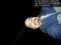
My silly grin. In the dark. And of course it's rotated wrong. Sigh. @40.5731,-74.6029
