Difference between revisions of "2013-12-13 47 7"
imported>Brocorb (→Achievements) |
imported>FippeBot m (Location) |
||
| (8 intermediate revisions by one other user not shown) | |||
| Line 1: | Line 1: | ||
| + | My geohashing-career started last sunday, when a friend of mine told me about it. | ||
| + | Today I had a few hours off, and i checked by the way today's coordinates. They were reachable, in the middle of a little village, even close enough to get there with the train in less than an hour! So I got ready, took my GPS-device and got started. | ||
| − | |||
| − | |||
| − | |||
| − | |||
| − | |||
| − | |||
| − | |||
| − | |||
{{meetup graticule | {{meetup graticule | ||
| lat=47 | | lat=47 | ||
| Line 18: | Line 12: | ||
__NOTOC__ | __NOTOC__ | ||
== Location == | == Location == | ||
| − | The location is very close to a trainstation, | + | The location is very close to a trainstation, in the middle of a small village, on the side of a road. |
== Participants == | == Participants == | ||
| Line 36: | Line 30: | ||
Image:P1010816.JPG | Logproof | Image:P1010816.JPG | Logproof | ||
</gallery> | </gallery> | ||
| + | [[Category: Meetup on 2013-12-13]] | ||
| + | [[Category: Meetup in 47 7]] | ||
== Achievements == | == Achievements == | ||
| Line 46: | Line 42: | ||
| name = Brocorb | | name = Brocorb | ||
| image = | | image = | ||
| + | }} | ||
| + | {{Public transport geohash | ||
| + | | latitude = 47 | ||
| + | | longitude = 7 | ||
| + | | date = 2013-12-13 | ||
| + | | busline = Bern - Roggwil, Schmitten | ||
| + | | name = Brocorb | ||
| + | | image = P1010815.JPG | ||
}} | }} | ||
| − | |||
| − | |||
| − | |||
| − | |||
| − | |||
| − | |||
| − | |||
| − | |||
| − | |||
| − | |||
[[Category:Expeditions]] | [[Category:Expeditions]] | ||
| − | |||
[[Category:Expeditions with photos]] | [[Category:Expeditions with photos]] | ||
| − | |||
| − | |||
| − | |||
| − | |||
| − | |||
[[Category:Coordinates reached]] | [[Category:Coordinates reached]] | ||
| − | + | {{location|CH|BE}} | |
| − | |||
| − | |||
| − | |||
| − | |||
| − | |||
| − | |||
| − | |||
| − | |||
| − | |||
| − | |||
| − | |||
| − | |||
| − | |||
| − | |||
| − | |||
| − | |||
| − | |||
Latest revision as of 04:54, 14 August 2019
My geohashing-career started last sunday, when a friend of mine told me about it. Today I had a few hours off, and i checked by the way today's coordinates. They were reachable, in the middle of a little village, even close enough to get there with the train in less than an hour! So I got ready, took my GPS-device and got started.
| Fri 13 Dec 2013 in 47,7: 47.2359006, 7.8162166 geohashing.info google osm bing/os kml crox |
Location
The location is very close to a trainstation, in the middle of a small village, on the side of a road.
Participants
Brocorb (talk) 18:18, 13 December 2013 (EST)
Plans
The plan is to get there and return with the next train, so the time is limited. From the trainstation I need to log and return within a half an hour. Due to the proximity to the trainstation this should easily be possible.
Expedition
All as planned. On the way home i recognized, that i should have taken a picture prooving the date as well. Hope the one i took is enough.
Photos
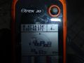
Logproof

Achievements
Brocorb earned the Land geohash achievement
|
Brocorb earned the Public transport geohash achievement
|