Difference between revisions of "2014-01-02 -35 149"
imported>1PE |
imported>Jiml m (Add Ribbon indicator) |
||
| Line 15: | Line 15: | ||
}} | }} | ||
| − | + | ||
__NOTOC__ | __NOTOC__ | ||
== Location == | == Location == | ||
| Line 29: | Line 29: | ||
== Expedition == | == Expedition == | ||
===[[User:1PE|1PE]]=== | ===[[User:1PE|1PE]]=== | ||
| − | I drove the ~15km to the site and parked by a street treet at the address in Donnelly Lane. I reached for my camera/phone and it told me that I was out of power for taking pictures. :-( I was at the locked gate, about 6m from the hash place in the yard. I could (just) look over the high fence and see the walkway beside the fence. There is a residence facing Devlin Street, and another over the two | + | I drove the ~15km to the site and parked by a street treet at the address in Donnelly Lane. I reached for my camera/phone and it told me that I was out of power for taking pictures. :-( |
| + | |||
| + | I was at the locked gate, about 6m from the hash place in the yard. I could (just) look over the high fence and see the walkway beside the fence. There is a residence facing Devlin Street, and another over the two vehicle garages facing Donnelly Lane. | ||
| + | |||
| + | I wrote a note on the print-out of the [http://carabiner.peeron.com/xkcd/map/map.html?date=2014-01-02&lat=-36&long=149&zoom=22&abs=1 peeron page] and put that in the letterbox for the Donnelly Lane property (the hash is nearer to it) and drove home. (Hello, occupants!) | ||
== Tracklog == | == Tracklog == | ||
| Line 35: | Line 39: | ||
== Photos == | == Photos == | ||
| − | + | ||
| − | |||
| − | |||
<gallery perrow="5"> | <gallery perrow="5"> | ||
Image:2014-01-02_-35_149_peeron.png|Where I went (no pic): Donnelly Lane | Image:2014-01-02_-35_149_peeron.png|Where I went (no pic): Donnelly Lane | ||
| Line 46: | Line 48: | ||
== Achievements == | == Achievements == | ||
{{#vardefine:ribbonwidth|800px}} | {{#vardefine:ribbonwidth|800px}} | ||
| − | |||
| − | |||
| − | |||
| − | |||
| − | |||
| − | |||
| + | * Land Geohash | ||
[[Category:Expeditions]] | [[Category:Expeditions]] | ||
[[Category:Coordinates reached]] | [[Category:Coordinates reached]] | ||
Revision as of 13:49, 2 January 2014
| Thu 2 Jan 2014 in -35,149: -35.1819622, 149.1367639 geohashing.info google osm bing/os kml crox |
Location
A gated/walled house's yard between two streets in Gungahlin, ACT
Participants
Plans
1PE
Go to either Devlin Street or Donnelly Lane and take a picture over the fence.
Expedition
1PE
I drove the ~15km to the site and parked by a street treet at the address in Donnelly Lane. I reached for my camera/phone and it told me that I was out of power for taking pictures. :-(
I was at the locked gate, about 6m from the hash place in the yard. I could (just) look over the high fence and see the walkway beside the fence. There is a residence facing Devlin Street, and another over the two vehicle garages facing Donnelly Lane.
I wrote a note on the print-out of the peeron page and put that in the letterbox for the Donnelly Lane property (the hash is nearer to it) and drove home. (Hello, occupants!)
Tracklog
Photos
Where I went (no pic): Donnelly Lane
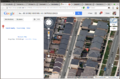
Duplexed side-ways, and front/rear residences on the block.
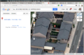
Orientation is South to top, to show the hash place in the yard. Also, see the street tree at the top-right, where I parked.


Achievements
- Land Geohash