Difference between revisions of "2014-01-12 50 8"
From Geohashing
imported>Yakamoz (→Plans) |
imported>Yakamoz (→Expedition) |
||
| Line 19: | Line 19: | ||
== Expedition == | == Expedition == | ||
| − | + | xxx | |
| − | |||
== Photos == | == Photos == | ||
Revision as of 16:40, 12 January 2014
| Sun 12 Jan 2014 in 50,8: 50.5469398, 8.7559078 geohashing.info google osm bing/os kml crox |
Location
In a seed plot, near Pohlheim (Hesse).
Participants
Plans
Use good weather to go to the nearest geohash which is 5 km away.
Expedition
xxx
Photos
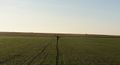
Coordinates reached, yay!

dirty shoes, again...

grin photo


Achievements
Yakamoz and Rincewind earned the Land geohash achievement
|