Difference between revisions of "2014-02-25 -35 149"
From Geohashing
imported>1PE |
imported>FippeBot m (Location) |
||
| (One intermediate revision by one other user not shown) | |||
| Line 53: | Line 53: | ||
{{#vardefine:ribbonwidth|800px}} | {{#vardefine:ribbonwidth|800px}} | ||
<!-- Add any achievement ribbons you earned below, or remove this section --> | <!-- Add any achievement ribbons you earned below, or remove this section --> | ||
| − | |||
| − | |||
| − | |||
| − | |||
| − | |||
| Line 64: | Line 59: | ||
[[Category:Coordinates reached]] | [[Category:Coordinates reached]] | ||
| + | {{location|AU|ACT}} | ||
Latest revision as of 05:39, 14 August 2019
| Tue 25 Feb 2014 in -35,149: -35.2212266, 149.0685680 geohashing.info google osm bing/os kml crox |
Location
On the bank of Ginninderra Creek, an important, local, urban creek in the Belconnen region of Canberra, beside the overflow dam of Lake Ginninderra.
Participants
Plans
- 1PE
- Well after dark, after several social activities tonight.
Expedition
- It was about 10.30pm when I'd finished up several other activities for the evening, and got to drive a short distance from home to the hash. The road surfaces on the main road were being repaired, and new lines marked at several corners. Detour time.
- I parked beside a road machine and walked into the bush, using a mobile phone's dull glow to prevent tripping on the tall grass and hidden rocks. Down by the creek, I could see the dam wall at the nearby road (the road crosses the dam wall) and navigated in using the phone's locator.
- After several pics, I walked back.
Tracklog
Photos

Road, dam, spillway, creek, hash.

Why AM I doing this late at night?

Leg of a power line tower.
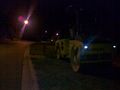
Serious late-night road building at the nearby corner meant I had several detours.


