Difference between revisions of "2014-03-04 50 12"
imported>Danatar (late report) |
imported>FippeBot m (Location) |
||
| Line 37: | Line 37: | ||
[[Category:Coordinates reached]] | [[Category:Coordinates reached]] | ||
[[Category:Danatar]] | [[Category:Danatar]] | ||
| + | {{location|DE|SN|V}} | ||
Latest revision as of 05:45, 14 August 2019
| Tue 4 Mar 2014 in Chemnitz: 50.5441660, 12.0551512 geohashing.info google osm bing/os kml crox |
Location
Today's location is next to the federal road leading through the forest between Syrau and Mehltheuer, near Plauen.
Country: Germany; state: Sachsen (Saxony, EU:DE:SN); district: Vogtlandkreis
Expedition
Danatar
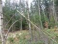
I was on my way to Dresden with this hashpoint only a small distance out of my way. I left the Autobahn at the Pirk exit, then drove through Plauen. Finding the route was easy, because I could stick to federal roads all the time. After passing Syrau, I stopped the car on a forest track that was branching off the federal road near the hashpoint. Then I walked into the forest. After about one minute I realized that I had already passed the hashpoint, so close was it to the road. Finding the spot was easy, with only a little bit of underbrush blocking my path. Getting back to the car was even quicker and I resumed my journey.
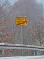
leaving Syrau
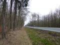
too far in the forest
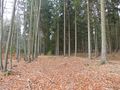
almost there
GPS

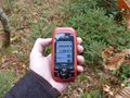
coordinates reached

panorama


