Difference between revisions of "2014-03-05 49 10"
From Geohashing
imported>Rincewind ([live picture] Yay. [http://www.openstreetmap.org/?lat=49.77404134&lon=10.02780650&zoom=16&layers=B000FTF @49.7740,10.0278]) |
imported>Jiml m (Adjust result codes) |
||
| Line 15: | Line 15: | ||
}} | }} | ||
| − | + | ||
__NOTOC__ | __NOTOC__ | ||
== Location == | == Location == | ||
| − | + | Near Wurzberg | |
== Participants == | == Participants == | ||
| − | + | ||
| − | + | * [[User:Rincewind|Rincewind]] | |
== Plans == | == Plans == | ||
| Line 32: | Line 32: | ||
*Got there. -- [[User:Rincewind|Rincewind]] ([[User talk:Rincewind|talk]]) [http://www.openstreetmap.org/?lat=49.77424379&lon=10.02762548&zoom=16&layers=B000FTF @49.7742,10.0276] 18:26, 5 March 2014 (CET) | *Got there. -- [[User:Rincewind|Rincewind]] ([[User talk:Rincewind|talk]]) [http://www.openstreetmap.org/?lat=49.77424379&lon=10.02762548&zoom=16&layers=B000FTF @49.7742,10.0276] 18:26, 5 March 2014 (CET) | ||
| + | |||
| + | |||
== Tracklog == | == Tracklog == | ||
<!-- if your GPS device keeps a log, you may post a link here --> | <!-- if your GPS device keeps a log, you may post a link here --> | ||
== Photos == | == Photos == | ||
| − | + | ||
| − | |||
| − | |||
<gallery perrow="5"> | <gallery perrow="5"> | ||
| − | |||
Image:2014-03-05_49_10_18-29-19-239.jpg | Yay. [http://www.openstreetmap.org/?lat=49.77404134&lon=10.02780650&zoom=16&layers=B000FTF @49.7740,10.0278] | Image:2014-03-05_49_10_18-29-19-239.jpg | Yay. [http://www.openstreetmap.org/?lat=49.77404134&lon=10.02780650&zoom=16&layers=B000FTF @49.7740,10.0278] | ||
</gallery> | </gallery> | ||
| Line 46: | Line 45: | ||
== Achievements == | == Achievements == | ||
{{#vardefine:ribbonwidth|800px}} | {{#vardefine:ribbonwidth|800px}} | ||
| − | |||
| + | * Land Geohash | ||
| − | |||
| − | |||
| − | |||
| − | |||
| − | + | [[Category:Expeditions]] | |
| − | |||
| − | [[Category: | ||
| − | |||
| − | |||
| − | |||
| − | |||
[[Category:Expeditions with photos]] | [[Category:Expeditions with photos]] | ||
| − | |||
| − | |||
| − | |||
| − | |||
| − | |||
[[Category:Coordinates reached]] | [[Category:Coordinates reached]] | ||
| − | |||
| − | |||
| − | |||
| − | |||
| − | |||
| − | |||
| − | |||
| − | |||
| − | |||
| − | |||
| − | |||
| − | |||
| − | |||
| − | |||
| − | |||
| − | |||
| − | |||
| − | |||
Revision as of 12:36, 6 March 2014
| Wed 5 Mar 2014 in 49,10: 49.7742498, 10.0276334 geohashing.info google osm bing/os kml crox |
Location
Near Wurzberg
Participants
Plans
Expedition
- Got there. -- Rincewind (talk) @49.7742,10.0276 18:26, 5 March 2014 (CET)
Tracklog
Photos
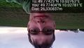
Yay. @49.7740,10.0278

Achievements
- Land Geohash