Difference between revisions of "2014-03-08 54 -2"
From Geohashing
imported>Angel ([live picture] View from the hash (3) ... How hard do you think it would be for someone on a real computer to stitch these images into a 360 degree panorama? [http://www.openstreetmap.org/?lat=54.04680000&lon=-2.84952000&zoom=16&layers=B000FTF @54.0468...) |
imported>Jiml m (Adjust result codes) |
||
| Line 15: | Line 15: | ||
}} | }} | ||
| − | + | ||
__NOTOC__ | __NOTOC__ | ||
== Location == | == Location == | ||
| − | + | In a field | |
== Participants == | == Participants == | ||
| Line 34: | Line 34: | ||
== Photos == | == Photos == | ||
| − | + | ||
| − | |||
| − | |||
<gallery perrow="5"> | <gallery perrow="5"> | ||
Image:2014-03-08_54_-2_13-16-22-114.jpg | Looks like it should be reachable :-) | Image:2014-03-08_54_-2_13-16-22-114.jpg | Looks like it should be reachable :-) | ||
| − | |||
Image:2014-03-08_54_-2_14-41-03-773.jpg | A great place to meet up after reaching the hash (if we can); but not quite there yet. [http://www.openstreetmap.org/?lat=54.04770000&lon=-2.84188000&zoom=16&layers=B000FTF @54.0477,-2.8419] | Image:2014-03-08_54_-2_14-41-03-773.jpg | A great place to meet up after reaching the hash (if we can); but not quite there yet. [http://www.openstreetmap.org/?lat=54.04770000&lon=-2.84188000&zoom=16&layers=B000FTF @54.0477,-2.8419] | ||
| − | |||
Image:2014-03-08_54_-2_14-47-38-266.jpg | Looks promising ... [http://www.openstreetmap.org/?lat=54.04520000&lon=-2.84798000&zoom=16&layers=B000FTF @54.0452,-2.8480] | Image:2014-03-08_54_-2_14-47-38-266.jpg | Looks promising ... [http://www.openstreetmap.org/?lat=54.04520000&lon=-2.84798000&zoom=16&layers=B000FTF @54.0452,-2.8480] | ||
| − | |||
Image:2014-03-08_54_-2_15-04-30-083.jpg | I'm sure there used to be a stile and bridge here [http://www.openstreetmap.org/?lat=54.04630000&lon=-2.85044000&zoom=16&layers=B000FTF @54.0463,-2.8504] | Image:2014-03-08_54_-2_15-04-30-083.jpg | I'm sure there used to be a stile and bridge here [http://www.openstreetmap.org/?lat=54.04630000&lon=-2.85044000&zoom=16&layers=B000FTF @54.0463,-2.8504] | ||
| − | |||
Image:2014-03-08_54_-2_15-58-57-781.jpg | From the lay-by at the side of the road ... Getting closer | Image:2014-03-08_54_-2_15-58-57-781.jpg | From the lay-by at the side of the road ... Getting closer | ||
| − | |||
Image:2014-03-08_54_-2_16-04-29-799.jpg | Yay! [http://www.openstreetmap.org/?lat=54.04690772&lon=-2.84952156&zoom=16&layers=B000FTF @54.0469,-2.8495] | Image:2014-03-08_54_-2_16-04-29-799.jpg | Yay! [http://www.openstreetmap.org/?lat=54.04690772&lon=-2.84952156&zoom=16&layers=B000FTF @54.0469,-2.8495] | ||
| − | |||
Image:2014-03-08_54_-2_16-10-41-045.jpg | View from the hash (1) [http://www.openstreetmap.org/?lat=54.04680000&lon=-2.84952000&zoom=16&layers=B000FTF @54.0468,-2.8495] | Image:2014-03-08_54_-2_16-10-41-045.jpg | View from the hash (1) [http://www.openstreetmap.org/?lat=54.04680000&lon=-2.84952000&zoom=16&layers=B000FTF @54.0468,-2.8495] | ||
| − | |||
Image:2014-03-08_54_-2_16-11-49-876.jpg | View from the hash (2) [http://www.openstreetmap.org/?lat=54.04680000&lon=-2.84952000&zoom=16&layers=B000FTF @54.0468,-2.8495] | Image:2014-03-08_54_-2_16-11-49-876.jpg | View from the hash (2) [http://www.openstreetmap.org/?lat=54.04680000&lon=-2.84952000&zoom=16&layers=B000FTF @54.0468,-2.8495] | ||
| − | |||
Image:2014-03-08_54_-2_16-14-57-242.jpg | View from the hash (3) ... How hard do you think it would be for someone on a real computer to stitch these images into a 360 degree panorama? [http://www.openstreetmap.org/?lat=54.04680000&lon=-2.84952000&zoom=16&layers=B000FTF @54.0468,-2.8495] | Image:2014-03-08_54_-2_16-14-57-242.jpg | View from the hash (3) ... How hard do you think it would be for someone on a real computer to stitch these images into a 360 degree panorama? [http://www.openstreetmap.org/?lat=54.04680000&lon=-2.84952000&zoom=16&layers=B000FTF @54.0468,-2.8495] | ||
</gallery> | </gallery> | ||
| Line 62: | Line 52: | ||
<!-- Add any achievement ribbons you earned below, or remove this section --> | <!-- Add any achievement ribbons you earned below, or remove this section --> | ||
| + | * Land Geohash | ||
| − | |||
| − | |||
| − | |||
| − | |||
| − | + | [[Category:Expeditions]] | |
| − | |||
| − | [[Category: | ||
| − | |||
| − | + | [[Category:Expeditions with photos]] | |
| − | |||
| − | |||
| − | [[Category:Expeditions with photos]] | ||
| − | |||
| − | |||
| − | |||
| − | |||
| − | |||
[[Category:Coordinates reached]] | [[Category:Coordinates reached]] | ||
| − | |||
| − | |||
| − | |||
| − | |||
| − | |||
| − | |||
| − | |||
| − | |||
| − | |||
| − | |||
| − | |||
| − | |||
| − | |||
| − | |||
| − | |||
| − | |||
| − | |||
| − | |||
Revision as of 21:40, 8 March 2014
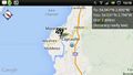
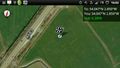
| Sat 8 Mar 2014 in 54,-2: 54.0468698, -2.8495280 geohashing.info google osm bing/os kml crox |
Location
In a field
Participants
Plans
Expedition
Tracklog
Photos
Looks like it should be reachable :-)
A great place to meet up after reaching the hash (if we can); but not quite there yet. @54.0477,-2.8419
Looks promising ... @54.0452,-2.8480

I'm sure there used to be a stile and bridge here @54.0463,-2.8504
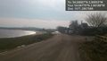
From the lay-by at the side of the road ... Getting closer
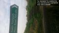
Yay! @54.0469,-2.8495
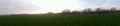
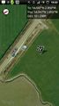
View from the hash (1) @54.0468,-2.8495

View from the hash (2) @54.0468,-2.8495
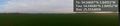
View from the hash (3) ... How hard do you think it would be for someone on a real computer to stitch these images into a 360 degree panorama? @54.0468,-2.8495


Achievements
- Land Geohash