Difference between revisions of "2014-03-11 51 12"
From Geohashing
imported>TFTD (Created) |
imported>FippeBot m (Location) |
||
| (2 intermediate revisions by one other user not shown) | |||
| Line 1: | Line 1: | ||
{{meetup graticule | {{meetup graticule | ||
| lat=51 | | lat=51 | ||
| − | | lon= | + | | lon=12 |
| date=2014-03-11 | | date=2014-03-11 | ||
}} | }} | ||
| Line 31: | Line 31: | ||
--> | --> | ||
<gallery perrow="5"> | <gallery perrow="5"> | ||
| + | Image:GPSShot.png | My GPS device. | ||
| + | Image:OneSiteShot1140311.png | A field! | ||
| + | Image:OneSiteShot2_140311.png | Another field! | ||
</gallery> | </gallery> | ||
| Line 40: | Line 43: | ||
<!-- =============== USEFUL CATEGORIES FOLLOW ================ | <!-- =============== USEFUL CATEGORIES FOLLOW ================ | ||
Delete the next line ONLY if you have chosen the appropriate categories below. If you are unsure, don't worry. People will read your report and help you with the classification.--> | Delete the next line ONLY if you have chosen the appropriate categories below. If you are unsure, don't worry. People will read your report and help you with the classification.--> | ||
| − | |||
| − | |||
| − | |||
<!-- Potential categories. Please include all the ones appropriate to your expedition --> | <!-- Potential categories. Please include all the ones appropriate to your expedition --> | ||
| − | |||
| − | |||
| − | |||
| − | + | [[Category: Meetup on 2014-03-11]] | |
| + | [[Category: Meetup in 51 12]] | ||
[[Category:Expeditions]] | [[Category:Expeditions]] | ||
| − | + | [[Category:Expeditions with photos]] | |
| − | [[Category:Expeditions with photos]] | ||
| − | |||
| − | |||
| − | |||
| − | |||
| − | |||
[[Category:Coordinates reached]] | [[Category:Coordinates reached]] | ||
| − | + | {{location|DE|ST|HAL}} | |
| − | |||
| − | |||
| − | |||
| − | |||
| − | |||
| − | |||
| − | |||
| − | |||
| − | |||
| − | |||
| − | |||
| − | |||
| − | |||
| − | |||
| − | |||
| − | |||
| − | |||
Latest revision as of 05:50, 14 August 2019
| Tue 11 Mar 2014 in 51,12: 51.4799291, 12.0318504 geohashing.info google osm bing/os kml crox |
Location
lat 51.479929 lon 12.03185 — on a field in east Halle — used http://geo.crox.net/poster/2014-03-11_51_12 instead, because the peeron map is down
Participants
Plans
I will take my bike to that place and probably walk the last meters.
Expedition
Nothing spectacular. A bike ride through the city. Finding a way to the field without disturbing someone. Saying hallo to a guy who looked strange at me, when I was on the field. Taking some pictures and riding back home. All in all a nice 1.5h workout in the sun.
Tracklog
Photos
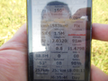
My GPS device.
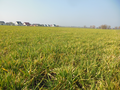
A field!
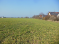
Another field!


