Difference between revisions of "2014-03-13 43 27"
imported>Kisolre ([live picture] Proof [http://www.openstreetmap.org/?lat=43.00631169&lon=27.88753478&zoom=16&layers=B000FTF @43.0063,27.8875]) |
imported>FippeBot m (Location) |
||
| (7 intermediate revisions by one other user not shown) | |||
| Line 18: | Line 18: | ||
__NOTOC__ | __NOTOC__ | ||
== Location == | == Location == | ||
| − | + | On the beach near Kamchia river firth. | |
== Participants == | == Participants == | ||
| − | + | [[user:kisolre|Kisolre]] and Vania | |
| − | |||
== Plans == | == Plans == | ||
| − | + | The hash seemed easy to reach and the weather was nice so we went for it. | |
== Expedition == | == Expedition == | ||
| − | + | Since the weather is cold here and crosing the river was not feasible we decided to aproach the hash from the south. There was a road that got us some 2.8km from the hash and it was walk on the beach from there. Because of recent knee surgery Vania couldn't walk this far so she waited some 2 km from the hash on the beach and I went there alone. The hash was in the midle of a sand meadow. I took some photos and headed back. While walking on the beach we found a lot of sand toys and are ready for the summer on the beach :) And despite all odds two of them were exactly the same - little blue planes. Nice spending of the day :) | |
| − | |||
| − | |||
| − | |||
== Photos == | == Photos == | ||
| Line 40: | Line 36: | ||
Image:2014-03-13_43_27_14-37-03-868.jpg | Proof [http://www.openstreetmap.org/?lat=43.00631169&lon=27.88753478&zoom=16&layers=B000FTF @43.0063,27.8875] | Image:2014-03-13_43_27_14-37-03-868.jpg | Proof [http://www.openstreetmap.org/?lat=43.00631169&lon=27.88753478&zoom=16&layers=B000FTF @43.0063,27.8875] | ||
| − | |||
| − | + | Image:2014-03-13_43_27_18-50-38-502.jpg | Toys found on the beach | |
| − | |||
| − | |||
| + | Image:2.5 km that way.jpg | 2.5 km that way | ||
| − | + | Image:Left to rest.jpg | Vania left to rest | |
| − | |||
| − | |||
| − | + | Image:Pano at the hash.jpg | Panorama at the hash | |
| − | + | Image:At the hash.jpg | Me at the hash | |
| − | < | + | </gallery> |
| − | |||
| − | |||
| − | |||
[[Category:Expeditions]] | [[Category:Expeditions]] | ||
| − | |||
[[Category:Expeditions with photos]] | [[Category:Expeditions with photos]] | ||
| − | |||
| − | |||
| − | |||
| − | |||
| − | |||
[[Category:Coordinates reached]] | [[Category:Coordinates reached]] | ||
| − | + | {{location|BG|B}} | |
| − | |||
| − | |||
| − | |||
| − | |||
| − | |||
| − | |||
| − | |||
| − | |||
| − | |||
| − | |||
| − | |||
| − | |||
| − | |||
| − | |||
| − | |||
| − | |||
| − | |||
Latest revision as of 05:51, 14 August 2019
| Thu 13 Mar 2014 in 43,27: 43.0062920, 27.8875099 geohashing.info google osm bing/os kml crox |
Location
On the beach near Kamchia river firth.
Participants
Kisolre and Vania
Plans
The hash seemed easy to reach and the weather was nice so we went for it.
Expedition
Since the weather is cold here and crosing the river was not feasible we decided to aproach the hash from the south. There was a road that got us some 2.8km from the hash and it was walk on the beach from there. Because of recent knee surgery Vania couldn't walk this far so she waited some 2 km from the hash on the beach and I went there alone. The hash was in the midle of a sand meadow. I took some photos and headed back. While walking on the beach we found a lot of sand toys and are ready for the summer on the beach :) And despite all odds two of them were exactly the same - little blue planes. Nice spending of the day :)
Photos

Proof @43.0063,27.8875
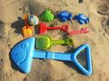
Toys found on the beach
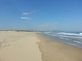
2.5 km that way
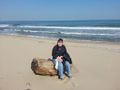
Vania left to rest
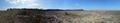
Panorama at the hash

Me at the hash


