Difference between revisions of "2014-04-11 54 8"
From Geohashing
imported>Yakamoz (→Achievements) |
imported>Yakamoz (→Achievements) |
||
| Line 45: | Line 45: | ||
{{#vardefine:ribbonwidth|800px}} | {{#vardefine:ribbonwidth|800px}} | ||
{{Land geohash | {{Land geohash | ||
| − | | latitude = 54 | + | | latitude = 54 |
| longitude = 8 | | longitude = 8 | ||
| date = 2014-04-11 | | date = 2014-04-11 | ||
| − | | name = | + | | name = rincewind |
| + | | image = proof101010.jpg | ||
}} | }} | ||
| − | |||
| − | |||
[[Category:Expeditions]] | [[Category:Expeditions]] | ||
[[Category:Expeditions with photos]] | [[Category:Expeditions with photos]] | ||
[[Category:Coordinates reached]] | [[Category:Coordinates reached]] | ||
Revision as of 14:03, 15 April 2014
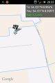
| Fri 11 Apr 2014 in 54,8: 54.2212586, 8.9949321 geohashing.info google osm bing/os kml crox |
Location
On a field near Neuenkirchen (Schleswig-Holstein, the North Sea area).
Participants
Plans
There was a unplanned geohash. We made an excursion to Westerhever lighthouse. Afterwards we drove spontaneously to the next geohash point.
Expedition
Tracklog
Photos
Coordinates reached

Achievements
rincewind earned the Land geohash achievement
|