Difference between revisions of "2014-04-18 49 8"
imported>DODO (→Plans) |
|||
| (6 intermediate revisions by 2 users not shown) | |||
| Line 17: | Line 17: | ||
<!-- edit as necessary --> | <!-- edit as necessary --> | ||
__NOTOC__ | __NOTOC__ | ||
| + | |||
| + | [[2014-04-16_49_8|previous]] [[2014-04-20 49 8|next]] | ||
| + | |||
== Location == | == Location == | ||
<!-- where you've surveyed the hash to be --> | <!-- where you've surveyed the hash to be --> | ||
| Line 32: | Line 35: | ||
== Expedition == | == Expedition == | ||
<!-- how it all turned out. your narrative goes here. --> | <!-- how it all turned out. your narrative goes here. --> | ||
| + | It all started half an hour later than expected as the household has to be done before hashing. The ride to the hash was rather uneventful except that it looks like rain more than once. Short before I reached the hashpoint the palatine vineyards begun, and so I hoped I find the hash in one of them, but when I reached the nearest walkable point, and had some vineyard on my right hand, the hashpoint turned out to be on the left hand side 50 m in a crop field. | ||
| + | |||
| + | Again I was looking for some tracktor tracks that would lead me to the hashpoint, and - lucky enough - I found some, although they were hardly visible in the green grass. I choose the wrong one again, as I missed the hashpoint by 8 m and I must admit, that I harmed some blades of crop when I changed the tracktor track. There wasn't very much to see and I didn't feel very comfortable in the middle of the field, so I left the hashpoint without even leaving a mark. I headed on the way I came , although it wasn't marked on my map, as a tron achievement seemed to be possible. Six kilometers before home it suddenly really get dark and some heavy raindrops started to fall. Lucky I was just at the truckstop in Schwegenheim, so I decided to endanger the tron achievement and to pass on the drowned rat achievement and to have some food instead. | ||
| + | |||
| + | It was in the late afternoon (around 4 pm) but nevertheless the truckstop was nearly completly occupied. Well, nearly was good enough for me. I found a table and had some real good palatine Leberknödelsuppe and a beer. When I was finished the rain had stopped to, and so I rode home in another half hour. | ||
| + | As "minimal, linear side trips" are acceptable for the tron (and I didn't take my bike with me into the truckstop nor to the hashpoint) I claim the achievement anyway. | ||
== Tracklog == | == Tracklog == | ||
<!-- if your GPS device keeps a log, you may post a link here --> | <!-- if your GPS device keeps a log, you may post a link here --> | ||
| + | [http://www.gpsies.com/map.do?fileId=fiuqmfnpshauqirw bike: 38 km Tron] | ||
== Photos == | == Photos == | ||
| Line 41: | Line 51: | ||
--> | --> | ||
<gallery perrow="5"> | <gallery perrow="5"> | ||
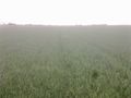
| + | Image:2014-04-18_49_8-1.jpg | vineyard at the right hand, geohash at the left hand | ||
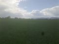
| + | Image:2014-04-18_49_8-2.jpg | view to the hash | ||
| + | Image:2014-04-18_49_8-3.jpg | bike | ||
| + | Image:2014-04-18_49_8-4.jpg | proof (2 m) | ||
| + | Image:2014-04-18_49_8-5.jpg | from the hash to the east | ||
| + | Image:2014-04-18_49_8-6.jpg | from the hash to the west | ||
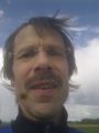
| + | Image:2014-04-18_49_8-7.jpg | view in my face | ||
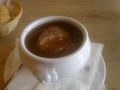
| + | Image:2014-04-18_49_8-8.jpg | Leberknödelsuppe | ||
| + | Image:2014-04-18_49_8-9.jpg | some drink inside, some rain outside | ||
</gallery> | </gallery> | ||
| Line 47: | Line 66: | ||
<!-- Add any achievement ribbons you earned below, or remove this section --> | <!-- Add any achievement ribbons you earned below, or remove this section --> | ||
| + | {{land geohash | ||
| − | + | | latitude = 49 | |
| − | + | | longitude = 8 | |
| − | + | | date = 2014-04-18 | |
| + | | name = DODO | ||
| + | }} | ||
| − | + | {{bicycle geohash | |
| + | | latitude = 49 | ||
| + | | longitude = 8 | ||
| + | | date = 2014-04-18 | ||
| + | | name = DODO | ||
| + | | distance = 38 KM | ||
| + | | bothways = true | ||
| + | }} | ||
| + | |||
| + | {{Template:Tron | ||
| + | | latitude = 49 | ||
| + | | longitude = 8 | ||
| + | | date = 2014-04-18 | ||
| + | | name = DODO | ||
| + | | possessive = his | ||
| + | | tracklog = http://www.gpsies.com/map.do?fileId=fiuqmfnpshauqirw | ||
| + | }} | ||
| − | |||
| − | |||
| − | |||
| − | |||
| − | |||
[[Category:Expeditions]] | [[Category:Expeditions]] | ||
| − | |||
[[Category:Expeditions with photos]] | [[Category:Expeditions with photos]] | ||
| − | |||
| − | |||
| − | |||
| − | |||
| − | |||
[[Category:Coordinates reached]] | [[Category:Coordinates reached]] | ||
| − | + | {{location|DE|RP|GER}} | |
| − | |||
| − | |||
| − | |||
| − | |||
| − | |||
| − | |||
| − | |||
| − | |||
| − | |||
| − | |||
| − | |||
| − | |||
| − | |||
| − | |||
| − | |||
| − | |||
| − | |||
Latest revision as of 15:37, 27 April 2020
| Fri 18 Apr 2014 in 49,8: 49.2560337, 8.2340552 geohashing.info google osm bing/os kml crox |
Location
On a field between Freimersheim and Hochstadt
Participants
Plans
It's close enough to go there by bike this afternoon. I want to leave home at 2 pm so I'll arrive around 3.
Expedition
It all started half an hour later than expected as the household has to be done before hashing. The ride to the hash was rather uneventful except that it looks like rain more than once. Short before I reached the hashpoint the palatine vineyards begun, and so I hoped I find the hash in one of them, but when I reached the nearest walkable point, and had some vineyard on my right hand, the hashpoint turned out to be on the left hand side 50 m in a crop field.
Again I was looking for some tracktor tracks that would lead me to the hashpoint, and - lucky enough - I found some, although they were hardly visible in the green grass. I choose the wrong one again, as I missed the hashpoint by 8 m and I must admit, that I harmed some blades of crop when I changed the tracktor track. There wasn't very much to see and I didn't feel very comfortable in the middle of the field, so I left the hashpoint without even leaving a mark. I headed on the way I came , although it wasn't marked on my map, as a tron achievement seemed to be possible. Six kilometers before home it suddenly really get dark and some heavy raindrops started to fall. Lucky I was just at the truckstop in Schwegenheim, so I decided to endanger the tron achievement and to pass on the drowned rat achievement and to have some food instead.
It was in the late afternoon (around 4 pm) but nevertheless the truckstop was nearly completly occupied. Well, nearly was good enough for me. I found a table and had some real good palatine Leberknödelsuppe and a beer. When I was finished the rain had stopped to, and so I rode home in another half hour. As "minimal, linear side trips" are acceptable for the tron (and I didn't take my bike with me into the truckstop nor to the hashpoint) I claim the achievement anyway.
Tracklog
Photos
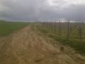
vineyard at the right hand, geohash at the left hand
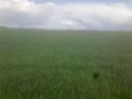
view to the hash
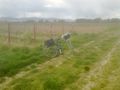
bike
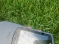
proof (2 m)
from the hash to the east
from the hash to the west
view in my face
Leberknödelsuppe
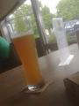
some drink inside, some rain outside


Achievements
DODO earned the Land geohash achievement
|
DODO earned the Bicycle geohash achievement
|
DODO earned the Tron achievement
|