Difference between revisions of "2014-04-20 49 8"
From Geohashing
imported>Yakamoz (→Expedition) |
imported>Yakamoz (→Achievements) |
||
| Line 61: | Line 61: | ||
<!-- Add any achievement ribbons you earned below, or remove this section --> | <!-- Add any achievement ribbons you earned below, or remove this section --> | ||
| + | {{#vardefine:ribbonwidth|800px}} | ||
| + | {{Land geohash | ||
| + | | latitude = 49 | ||
| + | | longitude = 8 | ||
| + | | date = 2014-04-20 | ||
| + | | name = [[User:Rincewind|Rincewind]] | ||
| + | }} | ||
| + | {{#vardefine:ribbonwidth|800px}} | ||
| + | {{Land geohash | ||
| + | | latitude = 49 | ||
| + | | longitude = 8 | ||
| + | | date = 2014-04-20 | ||
| + | | name = [[User:Yakamoz|Yakamoz]] | ||
| + | }} | ||
[[Category:Expeditions]] | [[Category:Expeditions]] | ||
[[Category:Expeditions with photos]] | [[Category:Expeditions with photos]] | ||
[[Category:Coordinates reached]] | [[Category:Coordinates reached]] | ||
Revision as of 19:39, 20 April 2014
| Sun 20 Apr 2014 in 49,8: 49.7741127, 8.4566122 geohashing.info google osm bing/os kml crox |
Location
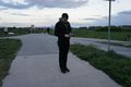
On a bicycle path next to Biebesheim.
Participants
Plans
To catch the train at 9:02 in Speyer, arrive in Gernsheim at 10:07, ride to the hash on my bicycle and ride on to Groß Gerau. Catch the train there at 11:55 and drive to Neuwied, where I'll visit my mother, before I cycle from hash to hash the following three days.
Expedition
Had a nice trip, all the train- and bicycle riding worked as planned. Will tell more and load some pictores when I'm at home again.
Expedition (Rincewind & Yakamoz)
Tracklog
Photos (Rincewind & Yakamoz)
Coordinates reached

Hashgrin...
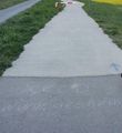
Discovery on the road
Discovery, another shot


Achievements
Rincewind earned the Land geohash achievement
|
Yakamoz earned the Land geohash achievement
|