Difference between revisions of "2014-04-30 42 -85"
From Geohashing
imported>Mcbaneg (Created page with "<!-- If you did not specify these parameters in the template, please substitute appropriate values for IMAGE, LAT, LON, and DATE (YYYY-MM-DD format) {{{image|dummy.jpg}}}|...") |
imported>Mcbaneg |
||
| Line 8: | Line 8: | ||
And DON'T FORGET to add your expedition and the best photo you took to the gallery on the Main Page! We'd love to read your report, but that means we first have to discover it! :) | And DON'T FORGET to add your expedition and the best photo you took to the gallery on the Main Page! We'd love to read your report, but that means we first have to discover it! :) | ||
--> | --> | ||
| − | [[Image:{{{image|2014-04-30 42 -85 | + | [[Image:{{{image|2014-04-30 42 -85 6.jpg}}}|thumb|left]] |
{{meetup graticule | {{meetup graticule | ||
| Line 39: | Line 39: | ||
--> | --> | ||
<gallery perrow="4"> | <gallery perrow="4"> | ||
| − | Image:2014-03007 42 -85 | + | Image:2014-03007 42 -85 6.jpg | View to northeast from hashpoint. |
| − | Image:2014-04-30 42 -85 | + | Image:2014-04-30 42 -85 7.jpg | Yours truly. |
| − | Image:2014-04- | + | Image:2014-04-30_proof.png | Proof! |
</gallery> | </gallery> | ||
Revision as of 00:27, 1 May 2014
| Wed 30 Apr 2014 in 42,-85: 42.9029067, -85.7529821 geohashing.info google osm bing/os kml crox |
Location
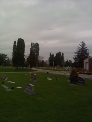
Grandville City Cemetery, Grandville, MI, USA
Participants
Expedition
Jeez, another cemetery geohash. This one was much less snowy than the last. Mostly I wanted to try out my new toy, my first phone with GPS and Geohash Droid. I suspect my rate of No-Batteries achievements will drop off now.
The closest I saw during the hashdance was something like 0.2 m but the screenshot I caught was just over a meter. GPS Test was reporting an error of 5 m, so I'll take this.
- 2014-03007 42 -85 6.jpg
View to northeast from hashpoint.
- 2014-04-30 proof.png
Proof!
Achievements
George earned the Land geohash achievement
|

