Difference between revisions of "2014-06-12 44 -123"
imported>Frogman (→Expedition) |
imported>FippeBot m (Location) |
||
| (2 intermediate revisions by one other user not shown) | |||
| Line 39: | Line 39: | ||
--> | --> | ||
<gallery perrow="5"> | <gallery perrow="5"> | ||
| + | Image:2014-06-12 44 -123 danger.jpg | Ominous! | ||
| + | Image:2014-06-12 44 -123 hill.jpg | On this hill sits the hashpoint. | ||
| + | Image:2014-06-12 44 -123 grin.jpg | Goofy grin. | ||
| + | Image:2014-06-12 44 -123 view1.jpg | View to the south. | ||
| + | Image:2014-06-12 44 -123 view2.jpg | View to the west. | ||
| + | Image:2014-06-12 44 -123 hashscot.jpg | My hashscot! | ||
</gallery> | </gallery> | ||
| Line 46: | Line 52: | ||
| − | |||
| − | |||
| − | |||
| − | |||
| − | |||
| − | |||
| − | |||
| − | |||
| − | |||
| − | |||
| − | |||
| − | |||
[[Category:Expeditions]] | [[Category:Expeditions]] | ||
| − | |||
[[Category:Expeditions with photos]] | [[Category:Expeditions with photos]] | ||
| − | |||
| − | |||
| − | |||
| − | |||
| − | |||
[[Category:Coordinates reached]] | [[Category:Coordinates reached]] | ||
| − | + | {{location|US|OR|BE}} | |
| − | |||
| − | |||
| − | |||
| − | |||
| − | |||
| − | |||
| − | |||
| − | |||
| − | |||
| − | |||
| − | |||
| − | |||
| − | |||
| − | |||
| − | |||
| − | |||
| − | |||
Latest revision as of 06:51, 14 August 2019
| Thu 12 Jun 2014 in 44,-123: 44.7045167, -123.3160857 geohashing.info google osm bing/os kml crox |
Location
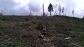
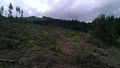
On a logged hillside in northern Benton County.
Participants
Plans
I contacted my friends but they all "had work" or were "out of town". Typical excuses! Looks like this is a solo expedition.
Expedition
I'm still getting used to driving manual transmission, so I drove carefully to the point. After turning at Adair Village, the road continued on and became gravel. There were a bunch of turn-offs and I had trouble figuring out which one to use, but eventually I found the right one. There was a sign warning of logging ahead, and forbidding parking, so I parked a little way down the road.
I walked up the logging road. It was a nice day! The walk was about a kilometer in the half, so definitely pretty easy. The hashpoint was in an already logged area. I could hear machinery in the background, presumably logging elsewhere.
Tracklog
Photos
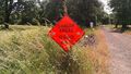
Ominous!
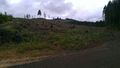
On this hill sits the hashpoint.

Goofy grin.
View to the south.
View to the west.
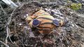
My hashscot!


