Difference between revisions of "2014-07-16 54 15"
imported>JRK (Created page with "{{meetup graticule | lat=54 | lon=15 | date=2014-07-16 | graticule_name=Kołobrzeg, Poland | graticule_link=Kołobrzeg, Poland}} == Location == Bogucino, south of Kołobrzeg ...") |
imported>JRK |
||
| Line 20: | Line 20: | ||
Image:Jrk31_01.jpg|Kołobrzeg City Hall. | Image:Jrk31_01.jpg|Kołobrzeg City Hall. | ||
Image:Jrk31_02.jpg|Some nice looking old buildings on the way. | Image:Jrk31_02.jpg|Some nice looking old buildings on the way. | ||
| − | Image: | + | Image:Jrk31_03.jpg|Two different bugs on one flower. |
Image:Jrk31_05.jpg|Some pond. | Image:Jrk31_05.jpg|Some pond. | ||
Image:Jrk31_07.jpg|Finally my destination - Bogucino. | Image:Jrk31_07.jpg|Finally my destination - Bogucino. | ||
Revision as of 18:52, 17 July 2014
| Wed 16 Jul 2014 in Kołobrzeg, Poland: 54.1091442, 15.6296753 geohashing.info google osm bing/os kml crox |
Location
Bogucino, south of Kołobrzeg
Participant
- JRK,
Expedition
Devirginization of Polish coast, part three! This time expedition to Kołobrzeg area, once again luckily near Pomeranian Way of St. James (http://www.en.re-create.pl/). I walked 28 km in total, visited city of Kołobrzeg for the first time in my life, got tan that prevents me from sleeping in the night (auch) and had a goood time :). The point was in a small village of Bogucino and was surprisingly hard to reach. I had to deal with crazy bull (and of course I was wearing red shirt that day), pass a forest that was more of a for-tre-ss that a forest, some swampy area - and all of that while wearing sandals. I was close to resigning, but then I remembered how some people are crossing croc-infested swamps to get to the geopoint, so I decided some ticks and nettles are not going to stop me!
Photos
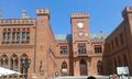
Kołobrzeg City Hall.
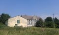
Some nice looking old buildings on the way.
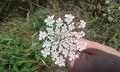
Two different bugs on one flower.
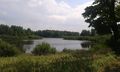
Some pond.
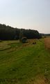
Finally my destination - Bogucino.
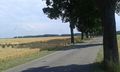
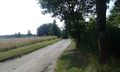
The road ends here, from now on - wilderness!
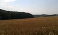
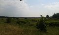
Some more fields to pass.
Geo cows (and one bull) guarding the way.
Back on Camino.
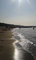
Resting on the beach in Kołobrzeg.
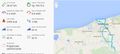
Endomondo proof of expediton.


Achievements
JRK earned the Land geohash achievement
|