Difference between revisions of "2014-07-19 47 8"
imported>DODO (→Gallery) |
imported>Ekorren (Gallery. Might write more of a report but not now.) |
||
| Line 19: | Line 19: | ||
== Gallery == | == Gallery == | ||
<gallery> | <gallery> | ||
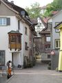
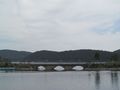
| − | + | 2014-07-19_47_8_5887.JPG|On an old bridge near Immendingen | |
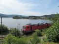
| + | 2014-07-19_47_8_5888.JPG|Vintage train at Blumberg | ||
| + | 2014-07-19_47_8_5895.JPG | ||
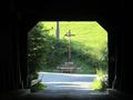
| + | 2014-07-19_47_8_5902.JPG|The hash is... down there in the canyon (below the trees) | ||
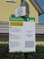
| + | 2014-07-19_47_8_5903.JPG|Deviation signs | ||
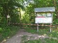
| + | 2014-07-19_47_8_5905.JPG|Access to waterfalls closed due to rockslide | ||
| + | 2014-07-19_47_8_5906.JPG|View on what would be the hiking trail near the hash | ||
| + | 2014-07-19_47_8_5907.JPG|The hash is behind these trees | ||
| + | 2014-07-19_47_8_5908.JPG|84 m is as close as it gets from this side | ||
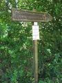
| + | 2014-07-19_47_8_5909.JPG|Larger deviation sign for hiking trail | ||
| + | 2014-07-19_47_8_5910.JPG|Second try from other side: This way to the waterfalls | ||
| + | 2014-07-19_47_8_5911.JPG|Closed again | ||
| + | 2014-07-19_47_8_5912.JPG|Different trail, same closure. | ||
| + | 2014-07-19_47_8_5913.JPG|Downhill racing? | ||
| + | 2014-07-19_47_8_5916.JPG|82 m is as close as it gets from this side. | ||
| + | 2014-07-19_47_8_5917.JPG|View back up the road | ||
| + | 2014-07-19_47_8_5918.JPG|Attention! Beavers! Don't leave wooden carts unattended! | ||
| + | 2014-07-19_47_8_5919.JPG|Random Black Forest bench | ||
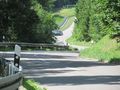
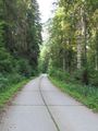
| + | 2014-07-19_47_8_5920.JPG|Random Black Forest road | ||
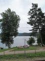
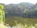
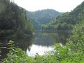
| + | 2014-07-19_47_8_5923.JPG|Schluchsee lake impressions | ||
| + | 2014-07-19_47_8_5924.JPG | ||
| + | 2014-07-19_47_8_5925.JPG | ||
| + | 2014-07-19_47_8_5926.JPG | ||
| + | 2014-07-19_47_8_5927.JPG | ||
| + | 2014-07-19_47_8_5929.JPG|Road down to the Rhine valley | ||
| + | 2014-07-19_47_8_5930.JPG | ||
| + | 2014-07-19_47_8_5932.JPG | ||
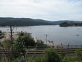
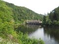
| + | 2014-07-19_47_8_5933.JPG|Another lake | ||
| + | 2014-07-19_47_8_5934.JPG | ||
| + | 2014-07-19_47_8_5935.JPG | ||
| + | 2014-07-19_47_8_5936.JPG|Tiengen town centre | ||
| + | 2014-07-19_47_8_5937.JPG | ||
</gallery> | </gallery> | ||
[[Category:Expeditions]] | [[Category:Expeditions]] | ||
| − | |||
| − | |||
[[Category:Expeditions with photos]] | [[Category:Expeditions with photos]] | ||
[[Category:Coordinates not reached]] | [[Category:Coordinates not reached]] | ||
[[Category:Not reached - Mother Nature]] | [[Category:Not reached - Mother Nature]] | ||
| − | |||
Revision as of 16:43, 2 November 2014
| Sat 19 Jul 2014 in 47,8: 47.8391212, 8.5193671 geohashing.info google osm bing/os kml crox |
Contents
Location
Blumberg, a steep canyon in the Black Forest, not accessible.
Participants
Ekorren went there by bike from Immendingen and continued deeper into the Black Forest.
Expedition
Gallery
On an old bridge near Immendingen
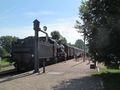
Vintage train at Blumberg
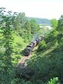
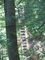
The hash is... down there in the canyon (below the trees)
Deviation signs

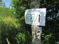
Access to waterfalls closed due to rockslide
View on what would be the hiking trail near the hash

The hash is behind these trees
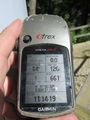
84 m is as close as it gets from this side
Larger deviation sign for hiking trail
Second try from other side: This way to the waterfalls
Closed again

Different trail, same closure.
Downhill racing?
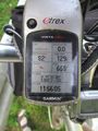
82 m is as close as it gets from this side.
View back up the road
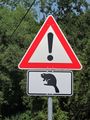
Attention! Beavers! Don't leave wooden carts unattended!
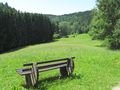
Random Black Forest bench
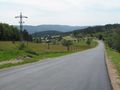
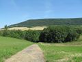
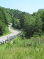
Random Black Forest road

Schluchsee lake impressions
Road down to the Rhine valley
Another lake
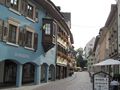
Tiengen town centre