Difference between revisions of "2014-08-17 52 0"
imported>Tongs (→Plans) |
m |
||
| (12 intermediate revisions by 2 users not shown) | |||
| Line 28: | Line 28: | ||
== Plans == | == Plans == | ||
| − | There were no plans. We realised the hashpoint was very close | + | There were no plans. We realised the hashpoint was very close, and we wanted to get there at 4pm, so we had about 90 minutes to spare. We packed a picnic and leapt into action. |
== Expedition == | == Expedition == | ||
| − | |||
| − | + | A day which was to be a trip to the local park turned into an expedition as we realised how close the hashpoint was to where we were (about 5km). We packed a box (the 'Emergency Fun Box') with a picnic, grabbed a football and, after a brief stop at the park, headed off to a small road, past the Felix Hotel, and parked up to follow a public footpath through some trees to the field. We arrived at 15:45, and left at about 16:30. | |
| − | + | ||
| + | This was our first geohashing expedition, and we're really lucky it was so easy. A concrete path led out to the middle of the field. We stopped a few metres short of its end and put the football at the point that our sophisticated GPS technology (our phones) said it was. We wondered if the previously-active Cambridge graticule would contain people willing to come out to such a convenient hashpoint, but none arrived. We ate Yoyo Bears, drank lemonade and played football. | ||
== Photos == | == Photos == | ||
| Line 40: | Line 40: | ||
Image:2012-##-## ## ## Alpha.jpg | Witty Comment | Image:2012-##-## ## ## Alpha.jpg | Witty Comment | ||
--> | --> | ||
| + | |||
<gallery perrow="5"> | <gallery perrow="5"> | ||
| + | Image:2014-08-17 52 0 FT.jpg | ||
| + | Image:2014-08-17 52 0 FTB.jpg | ||
| + | Image:2014-08-18 52 0 BT.jpg | ||
</gallery> | </gallery> | ||
| − | |||
| − | |||
| − | |||
| − | |||
| − | |||
| − | |||
| − | |||
| − | |||
| − | |||
| − | |||
| − | |||
| − | |||
| − | |||
| − | |||
| − | |||
| − | |||
| − | |||
[[Category:Expeditions]] | [[Category:Expeditions]] | ||
| − | |||
[[Category:Expeditions with photos]] | [[Category:Expeditions with photos]] | ||
| − | |||
| − | |||
| − | |||
| − | |||
| − | |||
[[Category:Coordinates reached]] | [[Category:Coordinates reached]] | ||
| + | == Retrohash revisit on 2017-04-29 == | ||
| + | |||
| + | Nearly three years later, we were invited to afternoon tea at the nearby Hotel Felix to celebrate a friend's birthday. After we said our goodbyes, we felt like going for a walk. Being very close to the hashpoint, we decided to revisit our first ever geohash. | ||
| − | + | This time there were crops growing, and a ground-nesting bird ascending and alarmed by our appearance. So as not to damage the crops, we settled for a nearby point, 52.2305502N and 0.1014371E, took photographs, and went on our way. | |
| − | |||
| − | |||
| − | |||
| − | |||
| − | |||
| − | |||
| − | |||
| − | + | <gallery perrow="5"> | |
| − | + | Image:2014-08-17 52 0 retro-1.jpg | Back again | |
| − | + | Image:2014-08-17 52 0 retro-2.jpg | Coordinates of the nearby point in Google Maps. | |
| − | + | </gallery> | |
| − | |||
| − | + | [[Category:Retro meetup]] | |
| + | [[Category:Retro coordinates reached]] | ||
| + | {{location|GB|ENG|CAM}} | ||
Latest revision as of 18:22, 11 September 2021
| Sun 17 Aug 2014 in 52,0: 52.2306145, 0.1015844 geohashing.info google osm bing/os kml crox |
Location
A field, ploughed with straw, just south of the A14. The hashpoint was a few metres off a very convenient concrete path.
Participants
Plans
There were no plans. We realised the hashpoint was very close, and we wanted to get there at 4pm, so we had about 90 minutes to spare. We packed a picnic and leapt into action.
Expedition
A day which was to be a trip to the local park turned into an expedition as we realised how close the hashpoint was to where we were (about 5km). We packed a box (the 'Emergency Fun Box') with a picnic, grabbed a football and, after a brief stop at the park, headed off to a small road, past the Felix Hotel, and parked up to follow a public footpath through some trees to the field. We arrived at 15:45, and left at about 16:30.
This was our first geohashing expedition, and we're really lucky it was so easy. A concrete path led out to the middle of the field. We stopped a few metres short of its end and put the football at the point that our sophisticated GPS technology (our phones) said it was. We wondered if the previously-active Cambridge graticule would contain people willing to come out to such a convenient hashpoint, but none arrived. We ate Yoyo Bears, drank lemonade and played football.
Photos


Retrohash revisit on 2017-04-29
Nearly three years later, we were invited to afternoon tea at the nearby Hotel Felix to celebrate a friend's birthday. After we said our goodbyes, we felt like going for a walk. Being very close to the hashpoint, we decided to revisit our first ever geohash.
This time there were crops growing, and a ground-nesting bird ascending and alarmed by our appearance. So as not to damage the crops, we settled for a nearby point, 52.2305502N and 0.1014371E, took photographs, and went on our way.
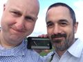
Back again
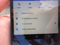
Coordinates of the nearby point in Google Maps.

