Difference between revisions of "2014-08-20 47 17"
imported>Patrizius (An expedition message sent via Geohash Droid for Android.) |
m (per Renaming Proposal) |
||
| (15 intermediate revisions by 4 users not shown) | |||
| Line 19: | Line 19: | ||
== Location == | == Location == | ||
<!-- where you've surveyed the hash to be --> | <!-- where you've surveyed the hash to be --> | ||
| + | From what I could see in Google Maps the hash was situated near some kind of lake near the small town of Hegyeshalom. It appeared to be fairly reachable, crossing the border on the motorway, then making the rest of the trip on regular roads. The 47-17 graticule was still missing on my list and the hash was located in the north-west corner, which was ideal considering me starting out at 48-16. So why not check it out.. | ||
== Participants == | == Participants == | ||
<!-- who attended: If you link to your wiki user name in this section, your expedition will be picked up by the various statistics generated for geohashing. You may use three tildes ~ as a shortcut to automatically insert the user signature of the account you are editing with. | <!-- who attended: If you link to your wiki user name in this section, your expedition will be picked up by the various statistics generated for geohashing. You may use three tildes ~ as a shortcut to automatically insert the user signature of the account you are editing with. | ||
--> | --> | ||
| + | * [[User:Patrizius|Patrizius]] | ||
== Plans == | == Plans == | ||
<!-- what were the original plans --> | <!-- what were the original plans --> | ||
| + | The plan was simple: Get there as fast as I can, as it was already late in the afternoon. Grab the hash. Get back home. | ||
== Expedition == | == Expedition == | ||
<!-- how it all turned out. your narrative goes here. --> | <!-- how it all turned out. your narrative goes here. --> | ||
| + | I rushed off in a hurry, forgetting my flashlight at home, which turned out to be quite the buzzkill. No problems on the motorway. I crossed the border, took the exit as planned and entered the small town of Hegyeshalom. According to my satnav I had to take a few turns which led me to a road, that was so bad I wouldn't have recognized it as a road on first glance. Nevertheless I kept moving on blindly trusting the technology. The last few hundred meters were particularly bad with potholes that I could almost hide in. The lake turned out to be some kind of basin with a huge wall alongside of it. The road took me right along this dam/wall, which was kind of impressive, as the area was very flat in general with only this dam raising up a few meters. The hash itself was located about 50 meters into a field. I walked the rest of the way, but the road was so bad at this point, it wouldn't have made any difference. <br> | ||
| + | After taking some photos I returned home without problems. | ||
| − | == | + | *Yay! -- [[User:Patrizius|Patrizius]] ([[User talk:Patrizius|talk]]) [http://www.openstreetmap.org/?lat=47.89361669&lon=17.14939867&zoom=16&layers=B000FTF @47.8936,17.1494] 14:22, 20 August 2014 (EDT) |
| − | |||
== Photos == | == Photos == | ||
| − | < | + | <gallery caption="Photo Gallery" widths="320px" heights="213px" perrow="3"> |
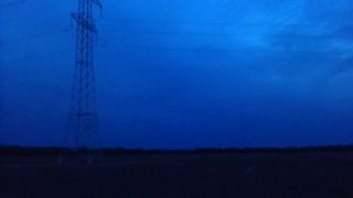
| − | Image: | + | Image:IMAG0819.jpg | me on the spot, patrizius in the dark |
| − | -- | + | Image:IMAG0821.jpg | the spot |
| − | + | Image:IMAG0822.jpg | it's getting dark over Hegyeshalom | |
| + | Image:2014-08-20_20-22-55.png | screenshot of GPS app | ||
| + | |||
</gallery> | </gallery> | ||
| Line 43: | Line 49: | ||
{{#vardefine:ribbonwidth|800px}} | {{#vardefine:ribbonwidth|800px}} | ||
<!-- Add any achievement ribbons you earned below, or remove this section --> | <!-- Add any achievement ribbons you earned below, or remove this section --> | ||
| + | {{Graticule unlocked | latitude = 47 | longitude = 17 | date = 2014-08-20 | name = patrizius | image = IMAG0819.jpg}} | ||
| + | {{Border geohash achievement | latitude = 47 | longitude = 17 | date = 2014-08-20 | country1= Austria | country2= Hungary | name = patrizius | image = IMAG0819.jpg }} | ||
| + | {{consecutive geohash 2 | count = 2 | latitude = 47 | longitude = 17 | date = 2014-08-20 | name = patrizius }} | ||
| − | |||
| − | |||
| − | |||
| − | |||
| − | |||
| − | |||
| − | |||
| − | |||
| − | |||
| − | |||
| − | |||
| − | |||
| − | |||
[[Category:Expeditions]] | [[Category:Expeditions]] | ||
| − | |||
| − | |||
| − | |||
| − | |||
| − | |||
| − | |||
| − | |||
[[Category:Coordinates reached]] | [[Category:Coordinates reached]] | ||
| − | + | {{location|HU|GS}} | |
| − | |||
| − | |||
| − | |||
| − | |||
| − | |||
| − | |||
| − | |||
| − | |||
| − | |||
| − | |||
| − | |||
| − | |||
| − | |||
| − | |||
| − | |||
| − | |||
| − | |||
Latest revision as of 05:09, 20 March 2024
| Wed 20 Aug 2014 in 47,17: 47.8936078, 17.1493727 geohashing.info google osm bing/os kml crox |
Location
From what I could see in Google Maps the hash was situated near some kind of lake near the small town of Hegyeshalom. It appeared to be fairly reachable, crossing the border on the motorway, then making the rest of the trip on regular roads. The 47-17 graticule was still missing on my list and the hash was located in the north-west corner, which was ideal considering me starting out at 48-16. So why not check it out..
Participants
Plans
The plan was simple: Get there as fast as I can, as it was already late in the afternoon. Grab the hash. Get back home.
Expedition
I rushed off in a hurry, forgetting my flashlight at home, which turned out to be quite the buzzkill. No problems on the motorway. I crossed the border, took the exit as planned and entered the small town of Hegyeshalom. According to my satnav I had to take a few turns which led me to a road, that was so bad I wouldn't have recognized it as a road on first glance. Nevertheless I kept moving on blindly trusting the technology. The last few hundred meters were particularly bad with potholes that I could almost hide in. The lake turned out to be some kind of basin with a huge wall alongside of it. The road took me right along this dam/wall, which was kind of impressive, as the area was very flat in general with only this dam raising up a few meters. The hash itself was located about 50 meters into a field. I walked the rest of the way, but the road was so bad at this point, it wouldn't have made any difference.
After taking some photos I returned home without problems.
- Yay! -- Patrizius (talk) @47.8936,17.1494 14:22, 20 August 2014 (EDT)
Photos
- Photo Gallery

me on the spot, patrizius in the dark
the spot
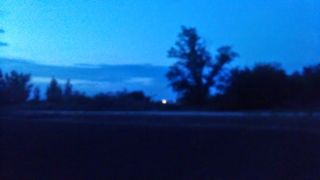
it's getting dark over Hegyeshalom
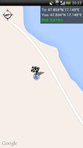
screenshot of GPS app


Achievements
patrizius earned the Graticule Unlocked Achievement
|
patrizius earned the Border geohash achievement
|
patrizius earned the Consecutive geohash achievement
|