Difference between revisions of "2014-09-01 44 -121"
imported>Anniepoo (→Achievements) |
imported>FippeBot m (Location) |
||
| (8 intermediate revisions by 3 users not shown) | |||
| Line 15: | Line 15: | ||
}} | }} | ||
| − | + | ||
__NOTOC__ | __NOTOC__ | ||
| + | |||
== Location == | == Location == | ||
Just off Soda Creek Trail, Deschutes National Forest, South of Broken Top and the South Sister. | Just off Soda Creek Trail, Deschutes National Forest, South of Broken Top and the South Sister. | ||
== Participants == | == Participants == | ||
| − | + | ||
| − | + | === Expedition 1=== | |
| − | [[User:Anniepoo | Anniepoo]] | + | *[[User:Anniepoo | Anniepoo]] |
| + | |||
| + | === Expedition 2=== | ||
| + | *[[User:Frogman|Frogman]] | ||
| + | *[[User:Benture|Benture]] | ||
| + | *Alison | ||
| + | *Kate | ||
| + | *Daisy | ||
== Plans == | == Plans == | ||
| − | + | ||
| + | ===Expedition 1=== | ||
Second day of two day hash. | Second day of two day hash. | ||
| + | |||
Sunday will drive to Bend on 20, stopping at the Wiley creek road to do the hash. | Sunday will drive to Bend on 20, stopping at the Wiley creek road to do the hash. | ||
After overnighting in Bend, I'll go on to the start point, pray for a parking space, and hike up to the hash point. Satellite says it's all slash, I hope that's not true, that could be slow going. | After overnighting in Bend, I'll go on to the start point, pray for a parking space, and hike up to the hash point. Satellite says it's all slash, I hope that's not true, that could be slow going. | ||
| + | ===Expedition 2=== | ||
| + | |||
| + | We're heading back to Portland from the [[La Pine, Oregon]] graticule and saw that this was quite easily doable! | ||
== Expedition == | == Expedition == | ||
| − | After driving to Bend, I now have a better understanding of what I'm seeing on Google maps in the area, and realized I was seeing the results of forest fire. | + | ===Expedition 1=== |
| + | After driving to Bend, I now have a better understanding of what I'm seeing on Google maps in the area, and realized I was seeing the results of forest fire. | ||
| + | |||
Since such areas are off limits (trudging across the burned landscape disrupts the healing ecosystem) there was no point in continuing. | Since such areas are off limits (trudging across the burned landscape disrupts the healing ecosystem) there was no point in continuing. | ||
So I called it off. With no reason to stay in Bend overnight, I turned around and came home. | So I called it off. With no reason to stay in Bend overnight, I turned around and came home. | ||
| − | == | + | ===Expedition 2=== |
| − | + | After a nice drive up the Cascade Lakes highway, we stopped at the Green Lakes trailhead under the shadow of South Sister and Broken Top. We took the lesser-used Soda Creek trail for about half a mile and then took a short jaunt off of the trail. The hashpoint was in a denser group of smaller trees. | |
| + | |||
== Photos == | == Photos == | ||
| − | + | ||
| − | |||
| − | |||
<gallery perrow="5"> | <gallery perrow="5"> | ||
| + | File:2014-09-01 44 -121 trail.jpg | The Soda Creek trail! | ||
| + | File:2014-09-01 44 -121 wilderness.jpg | The Three Sisters Wilderness! | ||
| + | File:2014-09-01 44 -121 grins.jpg | Goofy grins! | ||
| + | File:2014-09-01 44 -121 dog grins.jpg | Goofy dogs! | ||
</gallery> | </gallery> | ||
| + | |||
== Achievements == | == Achievements == | ||
| − | |||
| − | |||
| − | |||
| − | + | * Land Geohash for expedition 2 folks | |
| − | |||
| − | |||
| − | [[Category: | + | [[Category:Expeditions]] |
| − | [[Category: | + | [[Category:Expeditions with photos]] |
| − | [[Category: | + | [[Category:Coordinates reached]] |
| − | + | {{location|US|OR|DE}} | |
Latest revision as of 01:12, 15 August 2019
| Mon 1 Sep 2014 in 44,-121: 44.0341211, -121.7300125 geohashing.info google osm bing/os kml crox |
Location
Just off Soda Creek Trail, Deschutes National Forest, South of Broken Top and the South Sister.
Participants
Expedition 1
Expedition 2
Plans
Expedition 1
Second day of two day hash.
Sunday will drive to Bend on 20, stopping at the Wiley creek road to do the hash.
After overnighting in Bend, I'll go on to the start point, pray for a parking space, and hike up to the hash point. Satellite says it's all slash, I hope that's not true, that could be slow going.
Expedition 2
We're heading back to Portland from the La Pine, Oregon graticule and saw that this was quite easily doable!
Expedition
Expedition 1
After driving to Bend, I now have a better understanding of what I'm seeing on Google maps in the area, and realized I was seeing the results of forest fire.
Since such areas are off limits (trudging across the burned landscape disrupts the healing ecosystem) there was no point in continuing.
So I called it off. With no reason to stay in Bend overnight, I turned around and came home.
Expedition 2
After a nice drive up the Cascade Lakes highway, we stopped at the Green Lakes trailhead under the shadow of South Sister and Broken Top. We took the lesser-used Soda Creek trail for about half a mile and then took a short jaunt off of the trail. The hashpoint was in a denser group of smaller trees.
Photos
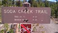
The Soda Creek trail!
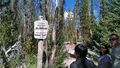
The Three Sisters Wilderness!
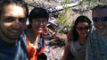
Goofy grins!

Goofy dogs!


Achievements
- Land Geohash for expedition 2 folks