Difference between revisions of "2014-09-09 48 16"
imported>Patrizius ([live] Gg) |
imported>FippeBot m (Location) |
||
| (10 intermediate revisions by 3 users not shown) | |||
| Line 1: | Line 1: | ||
| − | |||
| − | |||
| − | |||
| − | |||
| − | |||
| − | |||
| − | |||
| − | |||
| − | |||
| − | |||
{{meetup graticule | {{meetup graticule | ||
| lat=48 | | lat=48 | ||
| Line 15: | Line 5: | ||
}} | }} | ||
| − | |||
__NOTOC__ | __NOTOC__ | ||
== Location == | == Location == | ||
| − | + | The hash was located in a field near the famous archeological excavation site Carnuntum, about 40 kilometers outside Vienna. | |
== Participants == | == Participants == | ||
| − | + | ||
| − | + | * [[User:Patrizius|Patrizius]] | |
| + | * [[User:B2c|B2c]] | ||
| + | |||
== Plans == | == Plans == | ||
| − | + | The plan was to take the hashmobile out to Carnuntum via the A4 Autobahn and a bit of B9 Bundesstrasse. From what we could tell from Google Maps the hash was sitting in a field.. again. | |
| + | |||
== Expedition == | == Expedition == | ||
| − | + | Riding along the A4 was smooth, so we (or rather or navigation software) decided to stay on the A4 for a bit longer, take the slightly longer, but faster route to approach the hash from the south. In theory a good idea, but unfortunately it did not turn out to be faster after all. Just as we left the A4 we got stuck behind two enormous trucks transporting huge concrete structures that used almost all the road. We couldn't overtake them, so we trailed them almost all the way to Carnuntum. | |
| + | The hash was a little off the main road, in a field of small plants, green plants to be precise.. | ||
| + | Done the deed, back into the car again and off we went back home. | ||
| + | *Gg -- [[User:Patrizius|Patrizius]] ([[User talk:Patrizius|talk]]) [http://www.openstreetmap.org/?lat=48.10331758&lon=16.88961858&zoom=16&layers=B000FTF @48.1033,16.8896] 19:42, 9 September 2014 (CEST) | ||
| − | |||
== Tracklog == | == Tracklog == | ||
| − | + | [[File:Gpsvisualizer-wien-2014-09-09.png]] | |
| + | |||
== Photos == | == Photos == | ||
| − | < | + | <gallery caption="Photo Gallery" widths="320px" heights="213px" perrow="3"> |
| − | Image: | + | Image:IMG_20140909_192740.jpg | heavy load convoi |
| − | -- | + | Image:IMG_20140909_193636.jpg | approaching the fields |
| − | + | Image:IMG_20140909_193855.jpg | patrizius closing in on the hash. | |
| + | Image:IMG_20140909_193913.jpg | surrounded by wind turbines. | ||
| + | Image:IMG_20140909_193918.jpg | b2c shooting photos. | ||
| + | Image:IMG_20140909_193932.jpg | patrizius shooting photos. | ||
| + | Image:IMG_20140909_194241.jpg | stupid grin. sorry for the blurry foto, the lighting conditions were bad and we had to fight off a swarm of mosquitos. | ||
| + | Image:Screenshot_2014-09-09-19-42-07.jpg | Proof. | ||
| + | Image:Screenshot_2014-09-09-19-42-30.jpg | More proof. | ||
| + | |||
</gallery> | </gallery> | ||
| − | |||
| − | |||
| − | |||
| − | + | == Achievements == | |
| − | + | {{consecutive geohash 2 | |
| − | + | | count = 7 | |
| − | + | | latitude = 47 | |
| − | + | | longitude = 14 | |
| − | + | | date = 2014-09-03 | |
| − | + | | name = B2c | |
| − | + | }} | |
| − | + | {{consecutive geohash 2 | |
| − | + | | count = 7 | |
| + | | latitude = 47 | ||
| + | | longitude = 14 | ||
| + | | date = 2014-09-03 | ||
| + | | name = Patrizius | ||
| + | }} | ||
| − | |||
[[Category:Expeditions]] | [[Category:Expeditions]] | ||
| − | |||
[[Category:Expeditions with photos]] | [[Category:Expeditions with photos]] | ||
| − | |||
| − | |||
| − | |||
| − | |||
| − | |||
[[Category:Coordinates reached]] | [[Category:Coordinates reached]] | ||
| − | + | {{location|AT|NÖ|BL}} | |
| − | |||
| − | |||
| − | |||
| − | |||
| − | |||
| − | |||
| − | |||
| − | |||
| − | |||
| − | |||
| − | |||
| − | |||
| − | |||
| − | |||
| − | |||
| − | |||
| − | |||
Latest revision as of 01:20, 15 August 2019
| Tue 9 Sep 2014 in 48,16: 48.1033140, 16.8896225 geohashing.info google osm bing/os kml crox |
Location
The hash was located in a field near the famous archeological excavation site Carnuntum, about 40 kilometers outside Vienna.
Participants
Plans
The plan was to take the hashmobile out to Carnuntum via the A4 Autobahn and a bit of B9 Bundesstrasse. From what we could tell from Google Maps the hash was sitting in a field.. again.
Expedition
Riding along the A4 was smooth, so we (or rather or navigation software) decided to stay on the A4 for a bit longer, take the slightly longer, but faster route to approach the hash from the south. In theory a good idea, but unfortunately it did not turn out to be faster after all. Just as we left the A4 we got stuck behind two enormous trucks transporting huge concrete structures that used almost all the road. We couldn't overtake them, so we trailed them almost all the way to Carnuntum. The hash was a little off the main road, in a field of small plants, green plants to be precise.. Done the deed, back into the car again and off we went back home.
- Gg -- Patrizius (talk) @48.1033,16.8896 19:42, 9 September 2014 (CEST)
Tracklog

Photos
- Photo Gallery
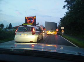
heavy load convoi
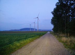
approaching the fields
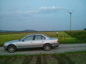
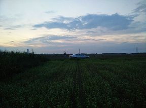
patrizius closing in on the hash.
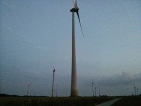
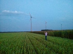
surrounded by wind turbines.
b2c shooting photos.
patrizius shooting photos.
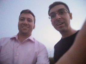
stupid grin. sorry for the blurry foto, the lighting conditions were bad and we had to fight off a swarm of mosquitos.
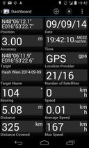
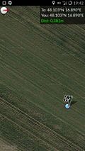
Proof.
More proof.


Achievements
B2c earned the Consecutive geohash achievement
|
Patrizius earned the Consecutive geohash achievement
|