Difference between revisions of "2014-09-13 48 16"
imported>Patrizius (→Photos) |
imported>B2c m (→Location) |
||
| Line 7: | Line 7: | ||
__NOTOC__ | __NOTOC__ | ||
== Location == | == Location == | ||
| − | The hash was located about 300 meters off the main road in a rural area near | + | The hash was located about 300 meters off the main road in a rural area near Dornbach, Lower Austria. |
== Participants == | == Participants == | ||
Revision as of 19:11, 13 September 2014
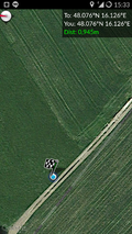
| Sat 13 Sep 2014 in 48,16: 48.0761641, 16.1263233 geohashing.info google osm bing/os kml crox |
Location
The hash was located about 300 meters off the main road in a rural area near Dornbach, Lower Austria.
Participants
Plans
The satellite images looked promising, so we decided to go for it. That pretty much sums up the whole plan.
Expedition
Starting out at the hashcave, we headed directly for the hash, just as our satnav told us. As a result we reached the spot in no time at all. The last few hundred meters were on gravel, but nothing the hashmobil couldn't handle. The hash itself was in a meadow just a few steps off the gravel road, which was a good thing, because it was starting to rain again and I was wearing a nice shirt, not to mention my good shoes.. So done the deed and off we went. Back home we realized that this had to be one of the quickest expeditions we had undertaken so far.
- ) -- Patrizius (talk) @48.0762,16.1263 15:33, 13 September 2014 (CEST)
Tracklog

Photos
- Photo Gallery
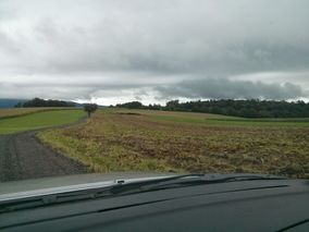
the hash was behind the tree close to the road
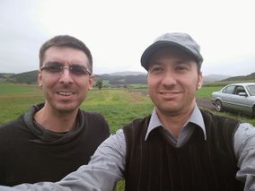
grin.
on the spot

data


