Difference between revisions of "2014-09-28 51 10"
From Geohashing
imported>GeorgDerReisende (testwise) |
imported>FippeBot m (Location) |
||
| (4 intermediate revisions by one other user not shown) | |||
| Line 1: | Line 1: | ||
| − | + | {{meetup graticule | |
| − | + | | lat=51 | |
| − | + | | lon=10 | |
| − | + | | date=2014-09-28 | |
| − | + | }} | |
| − | |||
| − | |||
| − | |||
| − | |||
| − | |||
| − | |||
| − | | lat= | ||
| − | | lon= | ||
| − | | date= | ||
| − | }} | ||
<!-- edit as necessary --> | <!-- edit as necessary --> | ||
__NOTOC__ | __NOTOC__ | ||
== Location == | == Location == | ||
| − | + | ||
| + | The hash lies on a fieldway near Altenburschla. | ||
== Participants == | == Participants == | ||
| − | + | ||
| − | + | [[User:GeorgDerReisende|GeorgDerReisende]] | |
== Plans == | == Plans == | ||
| − | + | ||
| + | Hitchhiking and walking. | ||
== Expedition == | == Expedition == | ||
| − | |||
| − | + | I left home at 10:45 and started to hitchhike at 11:45. I got the first lift after five minutes and with four cars I arrived at Wanfried at 13:50. From there I walked to the hash. I found it two meters beside a fieldway. For the way home I started at 15:10 and again with four cars I arrived at Kassel at 17:35 and at home at 18:30. | |
| − | |||
== Photos == | == Photos == | ||
| Line 38: | Line 28: | ||
--> | --> | ||
<gallery perrow="5"> | <gallery perrow="5"> | ||
| + | Image:2014-09-28 51 10 GeorgDerReisende 6975.jpg | the main street of Wanfried | ||
| + | Image:2014-09-28 51 10 GeorgDerReisende 6993.jpg | the main street of Altenburschla | ||
| + | Image:2014-09-28 51 10 GeorgDerReisende 6999.jpg | first view to the hash | ||
| + | Image:2014-09-28 51 10 GeorgDerReisende 7005.jpg | 20 meters to hash | ||
| + | Image:2014-09-28 51 10 GeorgDerReisende 7007.jpg | proof | ||
| + | Image:2014-09-28 51 10 GeorgDerReisende 7009.jpg | view to the north | ||
| + | Image:2014-09-28 51 10 GeorgDerReisende 7010.jpg | view to the east | ||
| + | Image:2014-09-28 51 10 GeorgDerReisende 7011.jpg | view to the south | ||
| + | Image:2014-09-28 51 10 GeorgDerReisende 7012.jpg | view to the west | ||
| + | Image:2014-09-28 51 10 GeorgDerReisende 7013.jpg | the geohasher | ||
</gallery> | </gallery> | ||
| Line 44: | Line 44: | ||
<!-- Add any achievement ribbons you earned below, or remove this section --> | <!-- Add any achievement ribbons you earned below, or remove this section --> | ||
| + | {{Thumbs Up | latitude = 51 | longitude = 10 | date = 2014-09-28 | name = GeorgDerReisende }} | ||
| − | + | [[Category:Expeditions]] | |
| − | |||
| − | [[Category: | ||
| − | + | [[Category:Expeditions with photos]] | |
| − | |||
| − | |||
| − | |||
| − | |||
| − | |||
| − | |||
| − | |||
| − | |||
| − | |||
| − | |||
| − | |||
| − | |||
| − | |||
| − | |||
[[Category:Coordinates reached]] | [[Category:Coordinates reached]] | ||
| − | + | {{location|DE|HE|WIZ}} | |
| − | |||
| − | |||
| − | |||
| − | |||
| − | |||
| − | |||
| − | |||
| − | |||
| − | |||
| − | |||
| − | |||
| − | |||
| − | |||
| − | |||
| − | |||
| − | |||
| − | |||
| − | |||
| − | |||
Latest revision as of 01:38, 15 August 2019
| Sun 28 Sep 2014 in 51,10: 51.1497133, 10.1861790 geohashing.info google osm bing/os kml crox |
Location
The hash lies on a fieldway near Altenburschla.
Participants
Plans
Hitchhiking and walking.
Expedition
I left home at 10:45 and started to hitchhike at 11:45. I got the first lift after five minutes and with four cars I arrived at Wanfried at 13:50. From there I walked to the hash. I found it two meters beside a fieldway. For the way home I started at 15:10 and again with four cars I arrived at Kassel at 17:35 and at home at 18:30.
Photos
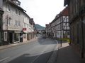
the main street of Wanfried
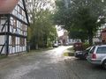
the main street of Altenburschla
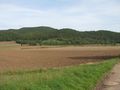
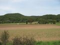
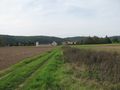
first view to the hash
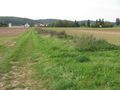
20 meters to hash

proof
view to the north
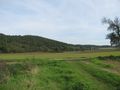
view to the east
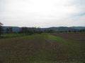
view to the south
view to the west
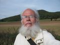
the geohasher


Achievements
GeorgDerReisende earned the Thumbs Up Geohash Achievement
|