Difference between revisions of "2014-09-28 54 -3"
From Geohashing
imported>Jiml m (Activate Template) |
imported>FippeBot m (Location) |
||
| Line 57: | Line 57: | ||
[[Category:Expeditions with photos]] | [[Category:Expeditions with photos]] | ||
[[Category:Coordinates reached]] | [[Category:Coordinates reached]] | ||
| + | {{location|GB|ENG|CMA}} | ||
Latest revision as of 01:38, 15 August 2019
| Sun 28 Sep 2014 in 54,-3: 54.1497133, -3.1861790 geohashing.info google osm bing/os kml crox |
Location
Green Lane, Dalton-in-Furness.
Participants
Currently it is just myself,
Nobody else arrived.
Plans
I am planning to cycle there, it will take me about 30 minutes. The location is a quiet suburban street, and it should not be a problem to reach.
Expedition
After an uneventful cycle ride across Barrow, I reached Green Lane and found the location. There was a car parked on the exact spot, but given the positional accuracy of civilian GPS it was close enough. I was a few minutes early, so I waited but nobody else arrived. I recorded my arrival at the hash and returned home for the write-up.
Photos

The meet-up location is conveniently marked by having a car parked on top of it. :-)

Auto Photo at the hash location
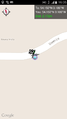
Screen capture from the XKCD geohashing app


Achievements
Alexandersmith earned the Land geohash achievement
|
Alexandersmith earned the Bicycle geohash achievement
|